The National Geologic Map Database is migrating to a new infrastructure. We apologize for any service disruptions during this process.
|
|---|


- Usage in publication:
-
- Lynnhaven Member
- Modifications:
-
- Named
- Dominant lithology:
-
- Sand
- AAPG geologic province:
-
- Atlantic Coast basin
Summary:
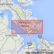
Lynnhaven, middle member of Tabb Formation (new name), is here named in southeastern VA. Unit consists of beach and nearshore marine deposits described as bluish-gray and reddish-brown gravelly and clayey sand. Thickness at the type section is 1.77 m; ranges <1 to 2 m. Unconformably overlies Sedgefield Member (new name), Norfolk Formation, or Yorktown Formation. Unconformably underlies Poquoson Member (new name). Age is late Pleistocene.
Source: GNU records (USGS DDS-6; Reston GNULEX).
- Usage in publication:
-
- Lynnhaven Member*
- Modifications:
-
- Areal extent
- AAPG geologic province:
-
- Atlantic Coast basin
Summary:
Late Pleistocene Tabb Formation and its three subdivisions, Sedgefield, Lynnhaven, and Poquoson Members, mapped west and south of Chesapeake Bay in the Virginia Coastal Plain. Thickness is 0 to 20 ft. Tabb Formation overlies middle Pleistocene Shirley Formation and underlies Holocene deposits.
Source: GNU records (USGS DDS-6; Reston GNULEX).

- Usage in publication:
-
- Lynnhaven Member
- Modifications:
-
- Overview
- AAPG geologic province:
-
- Atlantic Coast basin
Summary:
Nomenclature on State map follows Johnson (1976). Lynnhaven Member is middle member of Tabb Formation. Unit is composed of pebbly and cobbly, fine to coarse gray sand that grades upward into clayey and silty fine sand and sandy silt; locally, at base of unit, medium to coarse cross-bedded sand and clayey silt containing abundant plant material fill channels cut into underlying stratigraphic units. Surficial deposit of broad swale that is traceable southward from Norfolk; extensive lowlands bounded on landward side by river-, bay-, and ocean-facing scarps with toe altitudes of 15 to 18 ft. Thickness ranges 0 to 20 ft. Age is late Pleistocene.
Source: GNU records (USGS DDS-6; Reston GNULEX).
For more information, please contact Nancy Stamm, Geologic Names Committee Secretary.
Asterisk (*) indicates published by U.S. Geological Survey authors.
"No current usage" (†) implies that a name has been abandoned or has fallen into disuse. Former usage and, if known, replacement name given in parentheses ( ).
Slash (/) indicates name conflicts with nomenclatural guidelines (CSN, 1933; ACSN, 1961, 1970; NACSN, 1983, 2005, 2021). May be explained within brackets ([ ]).