

- Usage in publication:
-
- Lucky S formation
- Modifications:
-
- Named
- Dominant lithology:
-
- Quartzite
- Conglomerate
- Argillite
- AAPG geologic province:
-
- Sierra Nevada province
Summary:
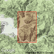
Lucky S formation named after Lucky S mine. Also referred to as Lucky S argillite. Type locality designated in Forman Ravine, west end of Forman Ridge, Mount Jura area [Taylorsville 7.5' quad, Plumas Co, CA]. Also occurs in Cooks Canyon and Starks Ravine. Consists of micaceous quartzite, with one or more fine conglomerates of chert and quartzite pebbles derived from much older deposits, grading upward into micaceous, dark-gray siltite and black argillite. Thickness is 600 ft. Very meager fauna in upper beds are not identifiable. Underlies Trail formation; overlies Cooks Canyon Formation (new). Is middle Late Jurassic age.
Source: GNU records (USGS DDS-6; Menlo GNULEX).

- Usage in publication:
-
- Lucky S Argillite*
- Modifications:
-
- Adopted
- Age modified
- AAPG geologic province:
-
- Sierra Nevada province
Summary:
Lucky S Argillite of Crickmay (1933) herein adopted. Correlation chart shows unit is composed of black slate and graywacke (600 to 1500 ft thick). Overlies Cooks Canyon Agglomerate and underlies Trail Formation. Age is Middle Jurassic (Callovian) based on stratigraphic relations.
Source: GNU records (USGS DDS-6; Menlo GNULEX).
For more information, please contact Nancy Stamm, Geologic Names Committee Secretary.
Asterisk (*) indicates published by U.S. Geological Survey authors.
"No current usage" (†) implies that a name has been abandoned or has fallen into disuse. Former usage and, if known, replacement name given in parentheses ( ).
Slash (/) indicates name conflicts with nomenclatural guidelines (CSN, 1933; ACSN, 1961, 1970; NACSN, 1983, 2005, 2021). May be explained within brackets ([ ]).