The National Geologic Map Database is migrating to a new infrastructure. We apologize for any service disruptions during this process.
|
|---|


- Usage in publication:
-
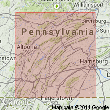
- Loysburg formation
- Modifications:
-
- Named
- Dominant lithology:
-
- Limestone
- Dolomite
- AAPG geologic province:
-
- Appalachian basin
Summary:
Named for Loysburg, Bedford Co., PA. Consists of dark and impure, dolomitic limestone. Thickness is greater than 115 feet. Overlies Beekmantown; underlies Carlim formation.
Source: GNU records (USGS DDS-6; Reston GNULEX).
- Usage in publication:
-
- Loysburg Formation
- Modifications:
-
- Overview
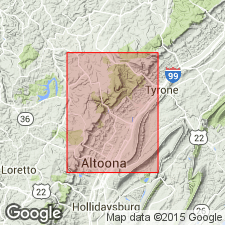
- Areal extent
- AAPG geologic province:
-
- Appalachian basin
Summary:
The Loysburg Formation extends throughout the Valley and Ridge province in central PA and can be traced in the subsurface from central NY to eastern OH according to Kay (1944). The lower portion is interbedded limestone and dolomite and is probably equivalent to the "tiger striped" Milroy Member though it is not well developed in the study area. The upper portion, or Clover Member, is sublithographic medium dark gray fine-grained limestone, which is thick to very thick bedded with no interbedded dolomite. Thickness measured along PA Rte 453 west of Pemberton is 28+/-1 m. The Milroy(?) is 22.2 m and the Clover is 6.0 m. Contact with underlying Bellefonte Formation is gradational and is placed at the lowest limestone bed. Upper contact with the fossiliferous Eyer Member of the Hatter Formation is sharp and conformable. Exposures, for the most part, are poor. The best exposure is along the west side of PA Rte 453, beginning at marker 11-75, west of Pemberton, 7 km east of the northeast corner of the Bellwood quad. Age is Middle Ordovician.
Source: GNU records (USGS DDS-6; Reston GNULEX).
For more information, please contact Nancy Stamm, Geologic Names Committee Secretary.
Asterisk (*) indicates published by U.S. Geological Survey authors.
"No current usage" (†) implies that a name has been abandoned or has fallen into disuse. Former usage and, if known, replacement name given in parentheses ( ).
Slash (/) indicates name conflicts with nomenclatural guidelines (CSN, 1933; ACSN, 1961, 1970; NACSN, 1983, 2005, 2021). May be explained within brackets ([ ]).