The National Geologic Map Database is migrating to a new infrastructure. We apologize for any service disruptions during this process.
|
|---|


- Usage in publication:
-
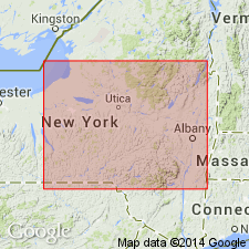
- Lowville limestone
- Modifications:
-
- Named
- Dominant lithology:
-
- Limestone
- AAPG geologic province:
-
- Appalachian basin
Summary:
Named the Lowville limestone for Lowville, Lewis Co., NY. Name replaces term Birdseye limestone of common usage. Unit is included in the Mohawkian group, and overlies the Chazy limestone and underlies the Black River limestone. The Lowville is of Middle Ordovician age.
Source: GNU records (USGS DDS-6; Reston GNULEX).
- Usage in publication:
-
- Lowville limestone
- Modifications:
-
- Revised
- AAPG geologic province:
-
- Appalachian basin
Summary:
Included the Lowville limestone in the Black River group when author raised the rank of the Black River. Unit is the basal formation within the group and called the lower part of the Lowville the Leray limestone member. The Leray limestone member consists of 10 feet of cherty limestone and the remainder of the formation consists of 22 to 55 feet of dove and blue-dove, thick- and thin-bedded limestone that is conglomeratic at base. Unit unconformably overlies the Pamelia limestone of the Chazy group and unconformably underlies the Watertown limestone. The Lowville is of Middle Ordovician age.
Source: GNU records (USGS DDS-6; Reston GNULEX).
- Usage in publication:
-
- Lowville formation
- Modifications:
-
- Overview
- AAPG geologic province:
-
- Appalachian basin
Summary:
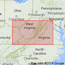
The Lowville formation is discussed as part of the Lowville-Moccasin unit in VA. Units are discussed together because the equivalent of upper three-fourths of Lowville in middle belt of the valley is a red argillaceous limestone or calcareous mudrock which has been referred to as Moccasin limestone. Unit overlies the Athens shale or Ottossee limestone and underlies the Eggleston limestone, Trenton limestone, or Martinsburg shale.
Source: GNU records (USGS DDS-6; Reston GNULEX).
- Usage in publication:
-
- Lowville formation
- Modifications:
-
- Overview
- AAPG geologic province:
-
- Appalachian basin
Summary:
Author suggests that the usage of the Lowville limestone be geographically restricted to New York, Ontario, and Quebec because only in these regions can the formation be shown to be a laterally continuous unit. Elsewhere, the unit is only a facies for so-called dove limestone. The Lowville overlies the Pamelia formation and underlies the Chaumont formation.
Source: GNU records (USGS DDS-6; Reston GNULEX).
- Usage in publication:
-
- Lowville limestone
- Modifications:
-
- Areal extent
- AAPG geologic province:
-
- Appalachian basin
Summary:
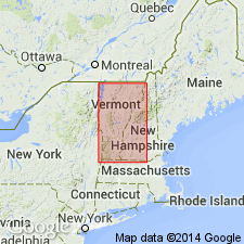
Geographically extended the Lowville limestone to VT. The Lowville is thin and undivided until near the base of the Orwell limestone. Unit is part of the Black River group.
Source: GNU records (USGS DDS-6; Reston GNULEX).
- Usage in publication:
-
- Lowville Formation
- Modifications:
-
- Revised
- Overview
- AAPG geologic province:
-
- Appalachian basin
Summary:
Blackriveran-Trentonian boundary is recognizable at the Lowville-Watertown boundary. Two new stratigraphic names are proposed for beds within the lower part of the Lowville: Little Catarqui Bed, composed of hard, black fissile, fossiliferous shale and intercalated dark limestone lenses, is developed only in southern Ontario; Barriefield Hill Metabentonite occurs in southern Ontario and NY. In addition, the Pencil Cave Metabentonite is present in northern NY and southern Ontario near the base of the upper Lowville, slightly below the Glenburnie Bed, and the Mud Cave Metabentonite is present at or near the top. Upper members of the Tyrone (KY) and the Carters (TN) and the Castlewood Member (reallocated) of the Plattin (MO) correlate with the late Blackriveran upper Lowville of NY.
Source: GNU records (USGS DDS-6; Reston GNULEX).
- Usage in publication:
-
- Lowville Formation
- Modifications:
-
- Revised
- AAPG geologic province:
-
- New England province
- Adirondack uplift
Summary:
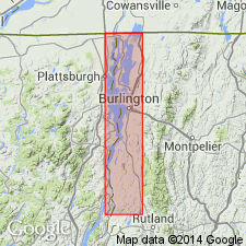
The Sawyer Bay is herein defined as a member of the Lowville Formation of the Black River Group. Occurs approximately in the middle of the Lowville throughout the Champlain Valley and represents a significant deepening event. Lower part of the Lowville was deposited in a shallow lagoonal environment, while the Sawyer Bay was deposited in a subtidal normal marine environment. Deposition probably the result of high angle block faulting in the Champlain basin. Member is very dark gray to black micrite to sparite in composition with irregular "lumpy" bedding, wavy lamination, cross-lamination, and ripple marks. Irregularly shaped, scattered chert nodules are concentrated in specific horizons. Contains a few large and small brachiopods, trilobite fragments and some fossil hash. Member is approximately 6 ft thick at Sawyer Point, South Hero Island, northwestern VT; thins to 2 ft at Arnold Bay, and becomes an indistinct rubbly unit at Crown Point, northeastern NY. The Lowville, at Crown Point, also contains the House Creek Member. The House Creek is also present in northwestern NY, southern Ontario, and the Black River Valley, but is not seen at Sawyer Point or Arnold Bay. The Lowville reaches a maximum thickness of 50 ft at Crown Point and a minimum of 24 ft at Sawyer Point. The Lowville overlies the Pamelia Formation and underlies the Chaumont Formation. Age is Middle Ordovician (Blackriveran).
Source: GNU records (USGS DDS-6; Reston GNULEX).
For more information, please contact Nancy Stamm, Geologic Names Committee Secretary.
Asterisk (*) indicates published by U.S. Geological Survey authors.
"No current usage" (†) implies that a name has been abandoned or has fallen into disuse. Former usage and, if known, replacement name given in parentheses ( ).
Slash (/) indicates name conflicts with nomenclatural guidelines (CSN, 1933; ACSN, 1961, 1970; NACSN, 1983, 2005, 2021). May be explained within brackets ([ ]).