The National Geologic Map Database is migrating to a new infrastructure. We apologize for any service disruptions during this process.
|
|---|


- Usage in publication:
-
- Lowland Creek Volcanics*
- Modifications:
-
- Named
- Dominant lithology:
-
- Volcanics
- Conglomerate
- Breccia
- Tuff
- Quartz monzonite
- Quartz latite
- AAPG geologic province:
-
- Montana folded belt
Summary:
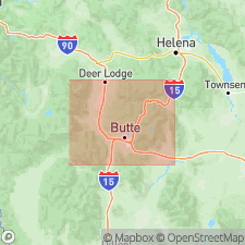
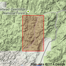
Named for creek in Elk Park quad, southwest MT. [Author mentions type area though does not specify its location. Type is presumably in area of Lowland Creek]. Crops out over 800 sq mi area (footnote 2, p.263) north and west of Butte, MT in Jefferson, Silver Bow, Deer Lodge, and Powell Cos, MT, Montana folded belt province. Volcanics accumulated in depressed area west of major structural lineament. Consists of six major units which are, in ascending order: a 500 ft-thick basal unit of conglomerate and other sedimentary rocks, with tuffaceous debris increasing upward; 3000-ft thick welded tuff unit of quartz latitic composition; 600-ft thick breccia unit of sandstone and conglomerate at base, grading upward to breccia of boulders and blocks of quartz monzonite and welded tuff to blocks of porphyritic quartz latite at top; 400 ft-thick lower lava unit of porphyritic quartz latite flows; 300 ft-thick vitrophyre unit; and 1000-ft thick upper lava unit of quartz latite flows. Total maximum accumulation is 5800 ft. Each unit is separated by an unconformity and each unit marks distinct phase in development of volcanic pile. Unconformably overlies rocks of Boulder batholith and older rocks; unconformably underlies younger rhyolite lavas and pyroclastics. Diagrammatic composite section. Age assigned as late Oligocene based on stratigraphic position with Miocene-age deposits near Missoula and presence of fossil leaves in basal unit.
Source: GNU records (USGS DDS-6; Denver GNULEX).
- Usage in publication:
-
- Lowland Creek Volcanics*
- Modifications:
-
- Age modified
- Geochronologic dating
- AAPG geologic province:
-
- Montana folded belt
Summary:
K-Ar date of 48 m.y. on biotite from welded tuff unit and 50 m.y. on biotite from vitrophyre lava unit establishes Lowland Creek as late Wasatchian (early Eocene) age. K-Ar age determinations indicate Lowland Creek is older that Climbing Arrow Formation in Three Forks area to east and may be approximate time equivalent to Milligan Creek Formation. Age of unit clearly establishes a pre-Eocene age for Boulder batholith; batholith and younger metalliferous quartz veins which cut it were uplifted and eroded to mature surface before Lowland Creek was deposited. Unit occurs north and west of Butte, MT in Montana folded belt province.
Source: GNU records (USGS DDS-6; Denver GNULEX).
For more information, please contact Nancy Stamm, Geologic Names Committee Secretary.
Asterisk (*) indicates published by U.S. Geological Survey authors.
"No current usage" (†) implies that a name has been abandoned or has fallen into disuse. Former usage and, if known, replacement name given in parentheses ( ).
Slash (/) indicates name conflicts with nomenclatural guidelines (CSN, 1933; ACSN, 1961, 1970; NACSN, 1983, 2005, 2021). May be explained within brackets ([ ]).