- Usage in publication:
-
- Lower Lake Formation*
- Modifications:
-
- Named
- Dominant lithology:
-
- Siltstone
- Sandstone
- AAPG geologic province:
-
- California Coast Ranges province
Summary:
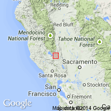
Named for exposures west, northwest, and northeast of town of Lower Lake, CA. Measured type section designated as exposures along west side of HWY 53 in Lower Lake, W/2 SW/4 SW/4 sec.2 T12N R7W, Lower Lake 7.5' quad, Lake Co, CA. Also exposed on north side of Wildcat Canyon, northwest and north of Seigler Canyon Creek and north and northwest of Clearlake Highlands. Formerly included in unrestricted Cache Formation by Becker (1888). Shown on geologic sketch map. Consists of pebbly sandstone and sandstone at its base; grades upward into siltstone with sandstone and tuff interbeds. Above this material are local beds of calcareous siltstone, limestone, tuff, sandstone, diatomite, and pebble conglomerate. Is 130 m thick at type section. Numerous fossils in unit are of little use in determining age. Unconformably laps over Cache Formation. Overlies, underlies, and interfingers with volcanic rocks of Pleistocene age (based on radiometric determinations).
Source: GNU records (USGS DDS-6; Menlo GNULEX).
For more information, please contact Nancy Stamm, Geologic Names Committee Secretary.
Asterisk (*) indicates published by U.S. Geological Survey authors.
"No current usage" (†) implies that a name has been abandoned or has fallen into disuse. Former usage and, if known, replacement name given in parentheses ( ).
Slash (/) indicates name conflicts with nomenclatural guidelines (CSN, 1933; ACSN, 1961, 1970; NACSN, 1983, 2005, 2021). May be explained within brackets ([ ]).

