- Usage in publication:
-
- Lovell member
- Modifications:
-
- Original reference
- AAPG geologic province:
-
- Wisconsin arch
Summary:
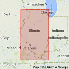
Pg. 153 (fig. 2), 154 (fig. 3), 155. Lovell member of Mount Simon formation. Name applied to relatively fine-grained unit overlying Kenyon member (new). Type section extends from depths of 2,850 to 2,975 feet. Thickness 65 to 190 feet. Underlies Mayfield member (new). Recognized in subsurface of northern Illinois. Age is Late Cambrian.
Type section (subsurface): depth-interval 2,850 to 2,975 feet, Wyman No. 1 (well 7), in NE/4 NE/4 SE/4 sec. 35, T. 41 N., R. 5 E., DeKalb Co., northeastern IL. Named from Lovell School, 0.75 mi south of type well.
Source: US geologic names lexicon (USGS Bull. 1200, p. 2248).
For more information, please contact Nancy Stamm, Geologic Names Committee Secretary.
Asterisk (*) indicates published by U.S. Geological Survey authors.
"No current usage" (†) implies that a name has been abandoned or has fallen into disuse. Former usage and, if known, replacement name given in parentheses ( ).
Slash (/) indicates name conflicts with nomenclatural guidelines (CSN, 1933; ACSN, 1961, 1970; NACSN, 1983, 2005, 2021). May be explained within brackets ([ ]).

