

- Usage in publication:
-
- Lost Gulch monzonite*
- Modifications:
-
- First used
- Dominant lithology:
-
- Quartz monzonite
- AAPG geologic province:
-
- Southwestern Basin-and-Range region
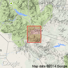
Summary:
Forms an area in Globe quad about 4 mi occupying Lost Gulch (source of name) and part of Pinal Creek, T1N, Rs14 and 15E, Gila Co, AZ in Southwestern Basin-and-Range region. No type locality designated. Intrudes Pinal schist. Is a fine-granular gray quartz monzonite. Contains scattered phenocrysts of potassium feldspar, and has smaller phenocrysts of plagioclase. Quartz is the most abundant constituent. Shown as younger than Ruin granite (first used) and older than Willow Spring granite (first used). Shown as pre-Cambrian on geologic map.
Source: GNU records (USGS DDS-6; Denver GNULEX).
- Usage in publication:
-
- Lost Gulch monzonite*
- Modifications:
-
- Overview
- Age modified
- Dominant lithology:
-
- Quartz monzonite
- Granodiorite
- AAPG geologic province:
-
- Basin-and-Range province
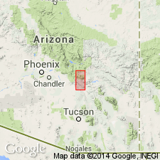
Summary:
Name applied to a monzonite body that occupies a quadrangular area about 4 sq mi in the Lost Gulch drainage north of Miami and northeast toward Pinal, Gila Co, AZ in the Basin-and-Range province. No type locality designated. The body is bounded by faults, except where it is overlapped by the Gila conglomerate to the east. Is cut by a diabase. Age relations unclear. Is probably early Mesozoic. Was considered pre-Cambrian age in an earlier report, but that age is doubtful. Consists of fine granular gray rock containing scattered crystals of potassium feldspar and smaller ones of plagioclase. Becomes more finely crystalline and the gray medium granular groundmass is made up of potassium feldspar, plagioclase, quartz, and biotite in the eastern exposures. Quartz is the most abundant constituent, followed by oligoclase-andesine feldspar, microcline, and biotite. Lies on the line between quartz monzonite and granodiorite. Generalized geologic map. [Probably mapped with other Tertiary granites.]
Source: GNU records (USGS DDS-6; Denver GNULEX).
- Usage in publication:
-
- Lost Gulch Quartz Monzonite*
- Modifications:
-
- Age modified
- Overview
- AAPG geologic province:
-
- Southwestern Basin-and-Range region
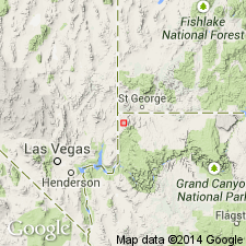
Summary:
Occurs in two irregularly shaped masses south of Sleeping Beauty fault, northern part of district, Southwestern Basin-and-Range region. Geologic map. Cross section. Consists mostly of coarse-grained porphyritic quartz monzonite that is indistinguishable in chemistry, mineralogy, and chemical composition from Ruin Granite. The porphyritic phase consists of potassium feldspar phenocrysts as much as 70 mm long in a medium-grained hypidiomorphic granular groundmass of quartz, plagioclase, potassium feldspar and biotite. The porphyry phase has phenocrysts of potassium feldspar smaller than those in the porphyritic phase in a groundmass that may be coarse or fine. K-Ar age of 1,106 m.y. is the oldest age obtained. The youngest age of 60.9 +/-0.7 m.y. was probably reset by the Schultze Granite intrusion. Was intruded by Precambrian diabase. Age modified from Late Cretaceous and early Tertiary to Precambrian Y.
Source: GNU records (USGS DDS-6; Denver GNULEX).
For more information, please contact Nancy Stamm, Geologic Names Committee Secretary.
Asterisk (*) indicates published by U.S. Geological Survey authors.
"No current usage" (†) implies that a name has been abandoned or has fallen into disuse. Former usage and, if known, replacement name given in parentheses ( ).
Slash (/) indicates name conflicts with nomenclatural guidelines (CSN, 1933; ACSN, 1961, 1970; NACSN, 1983, 2005, 2021). May be explained within brackets ([ ]).