

- Usage in publication:
-
- Lost Creek trachyte
- Modifications:
-
- Original reference
- Dominant lithology:
-
- Trachyte
- AAPG geologic province:
-
- Montana folded belt
- Yellowstone province
Summary:
Pg. 21-29, 78 (table 9), pl. 4. Lost Creek trachyte. Silicified, tuffaceous, porphyritic trachyte with phenocrysts of orthoclase and scattered lithic fragments; light shades of brown, buff, green, gray, or white. Commonly mottled; massive in appearance. Because of resistance to weathering and erosion, and vertical jointing, most exposures are vertical cliffs. Weathers in plates that form characteristic talus. Age is Miocene and (or) Pliocene.
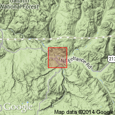
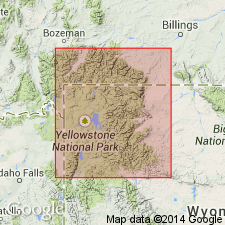
Scattered patches of rock exposed in Yellowstone Valley, in northern part of Yellowstone National Park, southwestern MT and northwestern WY. Best and most accessible exposures in valley of Lost Creek, near Tower Falls Ranger Station, in Grand Canyon of the Yellowstone, northern part of Yellowstone National Park, [Tower Junction 7.5-min quadrangle, Park Co., northern WY]. Derives name from this locality.
Source: US geologic names lexicon (USGS Bull. 1200, p. 2238).
- Usage in publication:
-
- Lost Creek Tuff Member*
- Modifications:
-
- Principal reference
- Revised
- Geochronologic dating
- Age modified
- AAPG geologic province:
-
- Montana folded belt
- Yellowstone province
Summary:
Pg. C10-C11 (fig. 8), C17. Lost Creek Tuff Member of Sepulcher Formation of Washburn Group of Absaroka Volcanic Supergroup. Lost Creek Trachyte of Howard (1937) reduced in rank to member of Sepulcher Formation (new). Present in northern Yellowstone National Park and surrounding area, northwestern Wyoming and southwestern Montana. Consists of sequence of yellowish-gray rhyodacite welded ash-flow sheets containing abundant phenocrysts of sanidine, andesine, and biotite, and sparse amounts of hornblende, but few or no phenocrysts of quartz. Flattened pumice, rock fragments (mainly of Precambrian metamorphic rocks) and charred wood, are common. The columnar and platy-jointed central densely welded zone is best exposed; the upper and lower partly welded zones are rarely exposed in the type area. Maximum thickness about 1,000 feet north of Sepulcher Mountain, between Reese and Stephens Creeks, southwestern Montana; is about 350 feet thick near type area. Lies above Elk Creek Basalt Member and below Daly Creek Member (both of Sepulcher Formation). K-Ar age (sanidine) of 49.2 +/-5 Ma (late Wasatchian or early Bridgerian NALMA), citing J.D. Obradovich (written commun., 1968). Age is considered late early Eocene (late Wasatchian NALMA).
Type area: near Lost Creek, northwest of Tower Junction, [Tower Junction 7.5-min quadrangle, Park Co., northwestern WY].
Source: Publication; Changes in stratigraphic nomenclature, 1972 (USGS Bull. 1502-A, p. A26-A27).
For more information, please contact Nancy Stamm, Geologic Names Committee Secretary.
Asterisk (*) indicates published by U.S. Geological Survey authors.
"No current usage" (†) implies that a name has been abandoned or has fallen into disuse. Former usage and, if known, replacement name given in parentheses ( ).
Slash (/) indicates name conflicts with nomenclatural guidelines (CSN, 1933; ACSN, 1961, 1970; NACSN, 1983, 2005, 2021). May be explained within brackets ([ ]).