

- Usage in publication:
-
- Los Vallos member*
- Modifications:
-
- Named
- Dominant lithology:
-
- Siltstone
- Sandstone
- Shale
- Gypsum
- AAPG geologic province:
-
- San Juan basin
- Orogrande basin
Summary:
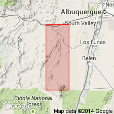
Los Vallos named as upper of two members of Yeso formation; Yeso divided into Meseta Blanca sandstone member (revised, at base) and Los Vallos member, which constitutes the bulk of the formation. Overlain by Glorieta sandstone member of San Andres formation. No type locality designated. Probably named for Los Vallos, Valencia Co, NM in San Juan basin. Consists of tan-brown, friable siltstone, sandstone, and shale with some gypsum predominant in upper half, 820-1,020 ft thick. Underlies west Los Vallos and forms the lower slopes of east face of Sierra Lucero in a broad belt extending from west edge of area in T5N into head of Carrizo Arroyo, Valencia Co, NM in San Juan basin. Still farther north forms floor and slopes of wide inner valley of Santa Fe Arroyo and head of Garcia Arroyo. Small outcrops near Monte de Belen in tributaries of Red Tanks Arroyo, Socorro Co, Orogrande basin. Member is severely deformed in Comanche thrust belt near Carrizo Arroyo, and beds of this unit are most commonly rocks exposed just east of 25-mi extent of the thrust. Lower part of member is dominantly a clastic unit, but contains several persistent thin limestone and thicker gypsum beds. In upper part of Los Vallos member, gypsum makes up about 50 percent of section. Is of Permian age. Measured sections, cross sections, geologic map.
Source: GNU records (USGS DDS-6; Denver GNULEX).
For more information, please contact Nancy Stamm, Geologic Names Committee Secretary.
Asterisk (*) indicates published by U.S. Geological Survey authors.
"No current usage" (†) implies that a name has been abandoned or has fallen into disuse. Former usage and, if known, replacement name given in parentheses ( ).
Slash (/) indicates name conflicts with nomenclatural guidelines (CSN, 1933; ACSN, 1961, 1970; NACSN, 1983, 2005, 2021). May be explained within brackets ([ ]).