The National Geologic Map Database is migrating to a new infrastructure. We apologize for any service disruptions during this process.
|
|---|


- Usage in publication:
-
- Los Tularcitos Member
- Modifications:
-
- Named
- Biostratigraphic dating
- Dominant lithology:
-
- Sandstone
- Conglomerate
- AAPG geologic province:
-
- California Coast Ranges province
Summary:
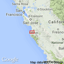
Named for extensive exposures in Los Tularcitos Spanish land grant. Type section designated along Robinson Canyon between Carmel Valley and Chamisal Ridge, Point Sur 15' quad, Monterey Co, CA. Also well exposed in drainage of Corral de Tierra north of Rancho Los Tularcitos, along south side of Carmel Valley west of Robinson Canyon and on north wall of San Jose Creek Canyon. Known to underlie at least 100 sq mi. Is upper member (of 2) of Chamisal Formation (new). Consists chiefly of marine medium- to coarse-grained, dark yellowish-brown arkosic sandstone and cobble conglomerate. Thickness at type is 400 ft. To southeast is 1100 ft thick. Grades downward into Robinson Canyon Member (new) of Chamisal Formation and upward into Los Laureles Member (new) of Monterey Formation. In vicinity of Carmelite Monastery at mouth of San Jose Creek may unconformably overlie Carmelo Formation. In some areas unconformably overlies granitic rocks. In upper Corral de Tierra Canyon conformably underlies Santa Margarita Formation. Is middle Miocene age based on megafossil fauna scattered throughout unit. List of fossils and localities in report.
Source: GNU records (USGS DDS-6; Menlo GNULEX).
For more information, please contact Nancy Stamm, Geologic Names Committee Secretary.
Asterisk (*) indicates published by U.S. Geological Survey authors.
"No current usage" (†) implies that a name has been abandoned or has fallen into disuse. Former usage and, if known, replacement name given in parentheses ( ).
Slash (/) indicates name conflicts with nomenclatural guidelines (CSN, 1933; ACSN, 1961, 1970; NACSN, 1983, 2005, 2021). May be explained within brackets ([ ]).