- Usage in publication:
-
- Los Moyos Limestone*
- Modifications:
-
- Original reference
- Dominant lithology:
-
- Limestone
- Shale
- AAPG geologic province:
-
- Estancia basin
- San Juan basin
Summary:
Pg. F4-F5, F6-F7 (fig. 2). Los Moyos Limestone of Madera Group. Consists of (ascending): (1) basal few feet of gradational beds, from the dark-colored calcareous shale and shaly limestone of the underlying Sandia formation; (2) 80 to 100 feet of cliff-forming olive- to medium-gray calcarenite; (3) cliff-forming cherty gray limestone, thin beds of dark-colored shale, and minor grayish-orange to orange siltstone, sandstone, and conglomerate; (4) top is cliff-forming calcarenite that in most places contain nodular masses of black chert. Thickness about 600 feet. Underlies Wild Cow Formation of Madera Group. Fossils (fusulinids). Age is late Middle to early Late Pennsylvanian (Desmoinesian to earliest Missourian).
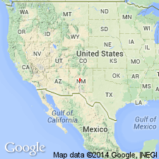
Type section [= type section of Wild Cow Formation]: on west side of Priest Canyon in an east-draining ravine that cuts through a hogback, in sec. 7, T. 3 N., R. 5 E., [approx. Lat. 34 deg. 30 min. 03 sec. N., Long. 106 deg. 27 min. 48 sec. N., southern edge of Manzano Peak 7.5-min quadrangle], Manzano Mountains, Valencia Co., central NM (Myers, 1973).
Named from Los Moyos Canyon [Canon de los Moyos] where unit is well exposed, in the Isleta Indian Reservation, in secs. 11 and 12, T. 7 N., R. 5 E. (projected), Bosque Peak 7.5-min quadrangle, Torrance Co., central NM.
Named from Los Moyos Canyon [Canon de los Moyos] where unit is well exposed, in the Isleta Indian Reservation, in secs. 11 and 12, T. 7 N., R. 5 E. (projected), Bosque Peak 7.5-min quadrangle, Torrance Co., central NM.
Reference sections: (1) exposures in Los Moyos Canyon [Canon de los Moyos]; and (2) measured section of Myers and McKay, 1970 (USGS Geol. Quad. Map GQ-795, lower part of Madera limestone, Pml map unit) south of Sol se Mete Canyon and northwest of Sol se Mete Peak, in sec. 29, T. 9 N., R. 5 E., Mount Washington 7.5-min quadrangle, Bernalillo Co., central NM.
Source: Publication; US geologic names lexicon (USGS Bull. 1520, p. 185-186).
- Usage in publication:
-
- Los Moyos Limestone*
- Modifications:
-
- Biostratigraphic dating
- AAPG geologic province:
-
- San Juan basin
Myers, D.A., 1988, Stratigraphic distribution of fusulinid Foraminifera from the Manzano Mountains, New Mexico: U.S. Geological Survey Professional Paper, 1446-A, p. 1-21.
Summary:
Pg. 6+, pls. Los Moyos Limestone of Madera Group. Consists of cliff-forming, massive, cherty, gray limestone, with subordinate amounts of dark-colored calcareous shale, sandstone, and minor conglomerate. Thickness averages 600 feet in the Manzano Mountains. Is basal formation of Madera Group. Gradationally overlies Sandia Formation; for mapping purposes, contact placed at base of lowest cherty, ledge- to cliff-forming, rusty orange-weathering limestone. Formation lies mostly within the fusulinid Foraminifera zone of BEEDEINA (assemblage subzones B. SULPHURENSIS, B. ROCKYMONTANA, B. NOVAMEXICANA, and B. INSOLITA, descending), indicating Desmoinesian. Upper 10 feet of formation, at a single locality, yielded fusulinid EOWAERINGELLA cf. E. JOYITAENSIS Stewart, 1968 (Cushman Foundation Foram. Research Spec. Pub., no. 10), of apparent earliest Missourian time. [Age of formation is considered late Middle Pennsylvanian (Desmoinesian).]
Source: Publication.
- Usage in publication:
-
- Los Moyos Limestone
- Modifications:
-
- Not used
- AAPG geologic province:
-
- San Juan basin
Kues, B.S., 2001, The Pennsylvanian System in New Mexico; Overview with suggestions for revisions of stratigraphic nomenclature: New Mexico Bureau of Geology and Mineral Resources, New Mexico Geology, v. 23, no. 4, p. 103-122.
Summary:
Pg. 110, 111, 116, etc. [Los Moyos Limestone of Madera Group of recent geologists not used. Is considered same as Gray Mesa Formation of Madera Group in Lucero uplift. See Gray Mesa.]
Source: Publication.
For more information, please contact Nancy Stamm, Geologic Names Committee Secretary.
Asterisk (*) indicates published by U.S. Geological Survey authors.
"No current usage" (†) implies that a name has been abandoned or has fallen into disuse. Former usage and, if known, replacement name given in parentheses ( ).
Slash (/) indicates name conflicts with nomenclatural guidelines (CSN, 1933; ACSN, 1961, 1970; NACSN, 1983, 2005, 2021). May be explained within brackets ([ ]).

