The National Geologic Map Database is migrating to a new infrastructure. We apologize for any service disruptions during this process.
|
|---|


- Usage in publication:
-
- Los Arrieros shale member
- Modifications:
-
- Original reference
- Dominant lithology:
-
- Shale
- AAPG geologic province:
-
- Gulf Coast basin
Summary:
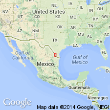
Pg. 259 (fig. 2), 266. Los Arrieros shale member of Yegua formation. Gray-green bentonitic locally sandy shale. Thickness approximately 110 feet. Uppermost member of formation; overlies Loma Blanca tongue; underlies Salineno sandstone tongue of Fayette formation. In some areas, underlies Rio Grande silts. Age is Eocene (Claiborne).
Named from village of Los Arrieros, located on bank of Rio Grande at north line of Roma 15-min quadrangle, [Starr Co.], southern TX.
Source: US geologic names lexicon (USGS Bull. 1200, p. 2232).
For more information, please contact Nancy Stamm, Geologic Names Committee Secretary.
Asterisk (*) indicates published by U.S. Geological Survey authors.
"No current usage" (†) implies that a name has been abandoned or has fallen into disuse. Former usage and, if known, replacement name given in parentheses ( ).
Slash (/) indicates name conflicts with nomenclatural guidelines (CSN, 1933; ACSN, 1961, 1970; NACSN, 1983, 2005, 2021). May be explained within brackets ([ ]).