The National Geologic Map Database is migrating to a new infrastructure. We apologize for any service disruptions during this process.
|
|---|


- Usage in publication:
-
- Lookout Mountain Ranch Drift*
- Modifications:
-
- Named
- Dominant lithology:
-
- Till
- AAPG geologic province:
-
- Cascades province
Summary:
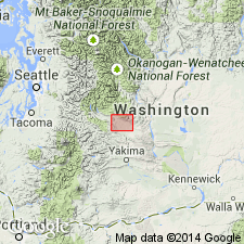
Named for ranch that occupies top of Lookout Mountain. Type locality designated as exposure at top of northwest scarp of Lookout Mountain, SE/4 SW/4 sec.36 T20N R16E, Cle Elum quad, Kittitas Co, WA. Consists of dark-gray to black till in lateral moraines. Is conspicuously weathered and produces reddish-brown soil. Thickness is approximately 50 m. Unit includes S.C. Porter's (1976) informal till facies of Thorp Drift; Porter's Thorp Drift is here restricted to its outwash facies and renamed Thorp Gravel. Unconformably overlies Grand Ronde Basalt. Is younger than Thorp Gravel and older than Kittitas Drift. Is Pleistocene age.
Source: GNU records (USGS DDS-6; Menlo GNULEX).
For more information, please contact Nancy Stamm, Geologic Names Committee Secretary.
Asterisk (*) indicates published by U.S. Geological Survey authors.
"No current usage" (†) implies that a name has been abandoned or has fallen into disuse. Former usage and, if known, replacement name given in parentheses ( ).
Slash (/) indicates name conflicts with nomenclatural guidelines (CSN, 1933; ACSN, 1961, 1970; NACSN, 1983, 2005, 2021). May be explained within brackets ([ ]).