

- Usage in publication:
-
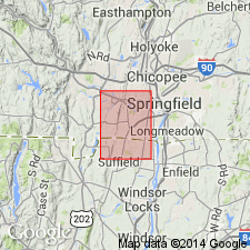
- Longmeadow brownstone
- Modifications:
-
- Named
- Dominant lithology:
-
- Sandstone
- AAPG geologic province:
-
- New England province
- Hartford basin
Summary:
The Triassic basin widens to the south, and as the coarse shoreward beds retain their width, a central area of sandstones, the Longmeadow brownstone or fucoidal sandstone, accumulated in a quieter situation. The central rocks are filled with tubular markings here called fucoids, "bird tracks", mud cracks, rain drops, curdled drying surfaces, and every indication of frequent immersion and emersion.
Source: GNU records (USGS DDS-6; Reston GNULEX).
- Usage in publication:
-
- Longmeadow sandstone*
- Modifications:
-
- Overview
- AAPG geologic province:
-
- New England province
- Hartford basin
Summary:
The Longmeadow sandstone represents the offshore facies of the Sugarloaf arkose. It consists of quartzose brown sandstone cemented by iron oxide, containing ferruginous concretions previously called fucoids, and other indications of shallow water deposition.
Source: GNU records (USGS DDS-6; Reston GNULEX).
- Usage in publication:
-
- Longmeadow†
- Modifications:
-
- Abandoned
- AAPG geologic province:
-
- New England province
- Hartford basin
Summary:
Rocks mapped by Emerson (1898) as Longmeadow sandstone in the Greenfield and northern Mount Toby quadrangles are here renamed the Turners Falls Sandstone as they cannot be traced into this area from the type area at Longmeadow.
Source: GNU records (USGS DDS-6; Reston GNULEX).
- Usage in publication:
-
- Longmeadow†
- Modifications:
-
- Areal extent
- Abandoned
- AAPG geologic province:
-
- New England province
- Hartford basin
Summary:
Rocks mapped by Emerson (1898) as Longmeadow Sandstone are assigned to the New Haven Arkose, East Berlin Formation, and Portland Arkose.
Source: GNU records (USGS DDS-6; Reston GNULEX).
- Usage in publication:
-
- Longmeadow†
- Modifications:
-
- Abandoned
- AAPG geologic province:
-
- New England province
- Hartford basin
Summary:
Rocks mapped as Longmeadow Sandstone by Emerson (1898) are here included in the stratigraphically equivalent Portland Arkose, here extended into Massachusetts from Connecticut. The Longmeadow Sandstone is abandoned as it is no longer recognized in its type area.
Source: GNU records (USGS DDS-6; Reston GNULEX).
For more information, please contact Nancy Stamm, Geologic Names Committee Secretary.
Asterisk (*) indicates published by U.S. Geological Survey authors.
"No current usage" (†) implies that a name has been abandoned or has fallen into disuse. Former usage and, if known, replacement name given in parentheses ( ).
Slash (/) indicates name conflicts with nomenclatural guidelines (CSN, 1933; ACSN, 1961, 1970; NACSN, 1983, 2005, 2021). May be explained within brackets ([ ]).