The National Geologic Map Database is migrating to a new infrastructure. We apologize for any service disruptions during this process.
|
|---|


- Usage in publication:
-
- Long Point Bed*
- Modifications:
-
- Named
- Reference
- Overview
- Dominant lithology:
-
- Sandstone
- Limestone
- AAPG geologic province:
-
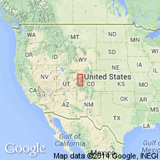
- Piceance basin
Summary:
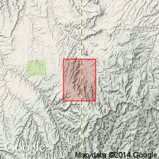
Named as a bed in the Eocene Green River Formation for Long Point, Garfield Co, CO in the Piceance basin. Type section measured in NE1/4 SW1/4 sec 18, T7S, R97W and is the basal bed of the Anvil Point Member at that section. Reference section measured in SE1/4 SE1/4 sec 7, T7S, R98W and is the basal bed of Garden Gulch Member at that section. Is a marker bed that ranges from an ostracod- and oolite-rich, medium-gray, medium to very fine-grained sandstone and grayish-white, ostracod- and oolite-rich sandstone. Clay partings common. Ranges from 20 cm to 14.6 cm thick. Has several gastropod-rich zones. Is thin or absent in central part of basin. Grades east into sandstone and loses its identity. Overlies Wasatch Formation at type and reference sections. Overlain by unnamed part of Anvil Points at type and of Garden Gulch at reference. Is also the basal bed of Douglas Creek Member. Areal limits of bed in and beyond basin included.
Source: GNU records (USGS DDS-6; Denver GNULEX).
- Usage in publication:
-
- Long Point Bed*
- Modifications:
-
- Areal extent
- AAPG geologic province:
-
- Uinta basin
Summary:
Extended to eastern UT and Uinta basin, and forms lower boundary of Douglas Creek Member of Eocene Green River Formation. Mapped in Davis Canyon quad, eastern Uintah Co, UT and western Garfield and Rio Blanco Cos, CO.
Source: GNU records (USGS DDS-6; Denver GNULEX).
For more information, please contact Nancy Stamm, Geologic Names Committee Secretary.
Asterisk (*) indicates published by U.S. Geological Survey authors.
"No current usage" (†) implies that a name has been abandoned or has fallen into disuse. Former usage and, if known, replacement name given in parentheses ( ).
Slash (/) indicates name conflicts with nomenclatural guidelines (CSN, 1933; ACSN, 1961, 1970; NACSN, 1983, 2005, 2021). May be explained within brackets ([ ]).