- Usage in publication:
-
- Lone Pine Formation*
- Modifications:
-
- Original reference
- Biostratigraphic dating
- AAPG geologic province:
-
- Great Basin province
Summary:
Pg. 2-7. Lone Pine Formation of Owens Valley Group. Mainly calcareous and siliceous mudstone with local conglomerate and quartzite. Thickness 309 m at type section. Is nearly 1,000 m thick in area between Reward Mine and Union Wash, Inyo Mountains, Inyo County, eastern California. Includes the Reward Conglomerate Member at top (truncated and not present at Lone Pine type). Conformably overlies Keeler Canyon Formation; underlies with angular unconformity Conglomerate Mesa Formation (new) of Owens Valley Group or, where absent, unnamed Triassic strata. Present throughout much of southern Inyo Mountains and in southern Last Chance Range. Age is considered Early Permian based on middle Wolfcampian to Leonardian(?) fusulinids.
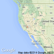
Type section (= type section of Conglomerate Mesa Formation): exposures in hill, locally called Permian Bluff, on west side of Inyo Mountains about 5 km northwest of Cerro Gordo Mine in southern part of New York Butte 15-min quadrangle, Inyo Co., eastern CA. Named from town of Lone Pine in Owens Valley, [Lone Pine 7.5-min quadrangle], Inyo Co., eastern CA.
Reference locality (= type locality of Owens Valley Formation, Merriam and Kirk, 1957): in foothills between Union Wash and Reward Mine about 9 mi southeast of Independence, between Owenyo and Kearsarge, in NE/4 Lone Pine 15-min quadrangle, southern Inyo Mountains, Inyo Co., eastern CA.
Source: Publication; GNU records (USGS DDS-6; Menlo GNULEX).
For more information, please contact Nancy Stamm, Geologic Names Committee Secretary.
Asterisk (*) indicates published by U.S. Geological Survey authors.
"No current usage" (†) implies that a name has been abandoned or has fallen into disuse. Former usage and, if known, replacement name given in parentheses ( ).
Slash (/) indicates name conflicts with nomenclatural guidelines (CSN, 1933; ACSN, 1961, 1970; NACSN, 1983, 2005, 2021). May be explained within brackets ([ ]).

