The National Geologic Map Database is migrating to a new infrastructure. We apologize for any service disruptions during this process.
|
|---|


- Usage in publication:
-
- Lone Butte limestone member
- Modifications:
-
- Original reference
- Dominant lithology:
-
- Limestone
- AAPG geologic province:
-
- Montana folded belt
- Sweetgrass arch
Summary:
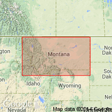
Pg. 43 and passim. Lone Butte limestone member of Jefferson limestone. Underlies Spotted Bear limestone and overlies Coopers Lake limestone, all members of Jefferson limestone. Known only in 5 sections: Lone Butte, Spotted Bear Mountain, Pentagon Mountain, Prairie Reef-White Ridge, and Dearborn; eroded in other sections. Thickest (637 feet) on White Ridge; thinnest (87 feet) on Monitor Mountain. Most striking characteristics are drab, dark-brown color, vitreous luster on fresh surfaces, and very petroliferous content. Type locality on southeast side of southern spur of Lone Butte, in NE/4 sec. 26, T. 23 N., R. 13 W. [unsurveyed, Silvertip 15-min quadrangle, Flathead County, northwestern Montana], where it is 421 feet thick and consists of (descending): (1) massive brown to steel-gray magnesian petroliferous limestone, thin-bedded in lower part, thicker-bedded and more massive upward, 170 feet; (2) massive chocolate to chocolate-gray fine-grained magnesian limestone that weathers white buff and to sharp angular surfaces; (3) steel-gray vitreous dolomitic arenaceous fine-grained petroliferous limestone that weathers light buff-brown, 141 feet; (4) thick-bedded tan to steel-gray vitreous, very petroliferous arenaceous limestone, porous in upper part, and weathering drab brown, 34 feet. Age is Middle Devonian.
Source: US geologic names lexicon (USGS Bull. 896, p. 1210).
For more information, please contact Nancy Stamm, Geologic Names Committee Secretary.
Asterisk (*) indicates published by U.S. Geological Survey authors.
"No current usage" (†) implies that a name has been abandoned or has fallen into disuse. Former usage and, if known, replacement name given in parentheses ( ).
Slash (/) indicates name conflicts with nomenclatural guidelines (CSN, 1933; ACSN, 1961, 1970; NACSN, 1983, 2005, 2021). May be explained within brackets ([ ]).