The National Geologic Map Database is migrating to a new infrastructure. We apologize for any service disruptions during this process.
|
|---|


- Usage in publication:
-
- Logtown Ridge agglomerates
- Modifications:
-
- Named
- Dominant lithology:
-
- Flows
- Tuffs
- Agglomerates
- AAPG geologic province:
-
- Sierra Nevada province
Summary:
Pg. 283. Logtown Ridge agglomerates. Upper formation of Amador group at its northern type section. Consists of flows, tuffs, and fine to coarse augite andesite agglomerates; they are 2,700 feet thick along west side of Mother Lode Highway [Highway 49] but thin and become finer in grain toward the west where they are several times repeated by folding. Overlies Cosumnes formation (new). Grades up into Mariposa formation. Correlates with Penon Blanco volcanics of Amador group at southern end on Merced River. Age of Amador group is believed to be late Middle to early Late Jurassic.
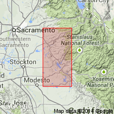
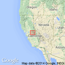
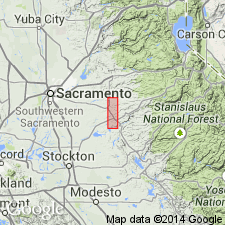
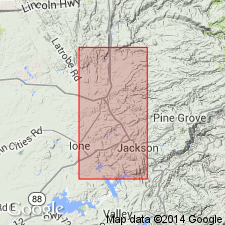
Type locality: at northern type section of †Amador Group [later abandoned] on Cosumnes River, El Dorado and Amador Cos., CA. Origin of name not stated by author, but probably named from Logtown Ridge, Lat. 38 deg. 36 min. 59 sec. N., Long. 120 deg. 51 min. 24 sec. W.
Source: US geologic names lexicon (USGS Bull. 1200, p. 2218); GNU records (USGS DDS-6; Menlo GNULEX).
- Usage in publication:
-
- Logtown Ridge formation
- Modifications:
-
- Areal extent
- Redescribed
- AAPG geologic province:
-
- Sierra Nevada province
Summary:
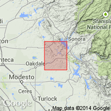
Logtown Ridge formation mapped in Copperopolis 15' quad, Tuolumne and Stanislaus Cos, CA. Consists of flows, tuffs, agglomerates and breccias; tuffaceous sediments, slate and chert. Slates are separately mapped. Intruded by quartz porphyry. Underlies Mariposa fm and unconformably overlies Calaveras group (undifferentiated). Assigned Late Jurassic age.
Source: GNU records (USGS DDS-6; Menlo GNULEX).
- Usage in publication:
-
- Logtown Ridge formation*
- Modifications:
-
- Areal extent
- AAPG geologic province:
-
- Sierra Nevada province
Summary:
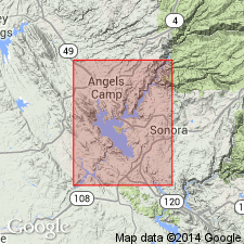
Mapped in Angels Camp and Sonora 7.5' quads. Generalized section is 2900 +/-50 feet thick. Consists predominantly of metamorphic rocks derived from coarse-grained, generally mafic, pyroclastics; mafic tuff; mafic flows, a little felsic tuff, and few thin beds of tuffaceous shale. In many parts of Sonora quad has been cut out by intrusive bodies and faults. Overlies Cosumnes fm; underlies Mariposa fm. Fossils (collected in SE/4 sec 20, T1N, R14E just NW of junction with HWY 49 and road to Montezuma in Sonora 7.5' quad, about 65 feet below top of unit) show features more common among Kimmeridgian than upper Oxfordian ammonites (Imlay, R.W., pers. commun., 3/9/50). Age is Middle or Late Jurassic.
Source: GNU records (USGS DDS-6; Menlo GNULEX).
- Usage in publication:
-
- Logtown Ridge Formation*
- Modifications:
-
- Biostratigraphic dating
- AAPG geologic province:
-
- Sierra Nevada province
Summary:
Age of Logtown Ridge Formation including type locality is Callovian to Oxfordian or Kimmeridgian based on ammonites.
Source: GNU records (USGS DDS-6; Menlo GNULEX).
- Usage in publication:
-
- Logtown Ridge formation*
- Modifications:
-
- Revised
- AAPG geologic province:
-
- Sierra Nevada province
Summary:
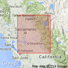
(See also L.D. Clark and others, 1963, San Andreas quadrangle, USGS Geol. Quad. Map GQ-222.) Logtown Ridge formation. Type section extends west from Huse Bridge on Highway 49 on Cosumnes River where upper contact is with unnamed epiclastic rocks previously included in Mariposa formation. Lower contact with Cosumnes formation is 7,400 feet southwest of Huse Bridge. Logtown Ridge formation of Eric and others (1955, California Div. Mines Spec. Rpt., no. 41) included rocks as far south as Chinese Camp and Taliaferro and Soleri [1949, California Div. Mines Bull., no. 145, map only] included volcanic rocks in vicinity of Copperopolis; these sequences will be given new names [Copper Hill volcanics and Gopher Ridge volcanics], because they occupy different stratigraphic positions from Logtown Ridge formation. Mapped from south part of Eldorado County to north of Highway 88 near Sutter Creek, Amador County, California. Age ranges from Callovian to late Oxfordian or early Kimmeridgian based on ammonites [identified by R.W. Imlay, written commun., 1959 (USGS Preliminary Report on Referred Fossils MD-59-14, May 20, 1959)]. [Callovian in this report included in Late Jurassic (Arkell, 1956) [?Jurassic geology of the world].]
[Author does not capitalize rank terms; however, units are considered formal.]
Source: Modified from GNU records (USGS DDS-6; Menlo GNULEX).
- Usage in publication:
-
- Logtown Ridge Formation*
- Modifications:
-
- Revised
- AAPG geologic province:
-
- Sierra Nevada province
Summary:
Logtown Ridge Formation removed from Amador Group, name herein abandoned. Contact with underlying Cosumnes Formation lowered 2000 ft to a fault contact at expense of Cosumnes Formation. As so redefined includes all previously reported fossiliferous rocks of Late Jurassic age.
Source: GNU records (USGS DDS-6; Menlo GNULEX).
- Usage in publication:
-
- Logtown Ridge Formation*
- Modifications:
-
- Revised
- AAPG geologic province:
-
- Sierra Nevada province
Summary:
Divided into 4 newly-named members (ascending); Rabbit Flat, Goat Hill, Pokerville, and New Chicago Members. Members shown on map from Cosumnes River S to Mokelumne River. Logtown Ridge Formation recognized N of Amador, but some controversy exists as to southward regional stratigraphic correlation.
Source: GNU records (USGS DDS-6; Menlo GNULEX).

- Usage in publication:
-
- Logtown Ridge Formation*
- Modifications:
-
- Age modified
- Biostratigraphic dating
- AAPG geologic province:
-
- Sierra Nevada province
Summary:
Logtown Ridge Formation was dated as late early Callovian to late Oxfordian on basis of PSEUDOCADOCERAS in its lower 600 ft and IDOCERAS cf. I PLANURA (Heyl) near the top. Lower part of Logtown Ridge Formation (or equivalent Gopher Ridge Vol.) as exposed along foothills of Sierra Nevada could locally be Bathonian age. Rogue Formation may be N extension of Logtown but Rogue was deposited under somewhat different environmental conditions. Age of Logtown Ridge Formation is Middle and Late Jurassic.
Source: GNU records (USGS DDS-6; Menlo GNULEX).
For more information, please contact Nancy Stamm, Geologic Names Committee Secretary.
Asterisk (*) indicates published by U.S. Geological Survey authors.
"No current usage" (†) implies that a name has been abandoned or has fallen into disuse. Former usage and, if known, replacement name given in parentheses ( ).
Slash (/) indicates name conflicts with nomenclatural guidelines (CSN, 1933; ACSN, 1961, 1970; NACSN, 1983, 2005, 2021). May be explained within brackets ([ ]).