- Usage in publication:
-
- Log Springs formation
- Modifications:
-
- Named
- Dominant lithology:
-
- Shale
- Sandstone
- Conglomerate
- AAPG geologic province:
-
- San Juan basin
- Estancia basin
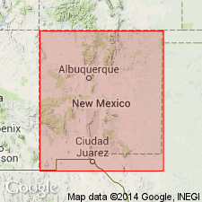
Summary:
Named for Log Springs in Penasco Canyon, Nacimiento Mountains, where type section measured in NW1/4 SE1/4 sec 5, T16N, R1E, Sandoval Co, NM, San Juan basin. Unconformably overlies Mississippian Arroyo Penasco formation (new); unconformably above the Log Springs in Arroyo Penasco Canyon and Guadalupe Box Canyon, Jemez Mountains, is a 25-40-ft bed of arenaceous limestone containing SCHIZOPHORIA OKLAHOMAE and MILLERELLA fauna of Morrow age, which is in turn unconformably overlain by Middle Pennsylvanian upper arkosic limestone member of Madera formation. Consists of 60-75 ft of ferruginous shales, sandstones, and conglomerates. The immediately underlying part of Arroyo Penasco formation is brecciated and contains numerous solution cavities filled with basal ferruginous shales from overlying Log Springs. Basal shale of Log Springs is highly ferruginous, with numerous oolites of hematite, and is followed by a medium-bedded series of deep-red shales, sandstones, and conglomerates. The sandstones tend to form small prominent ledges. Lower beds contain sporadic rounded pebbles of Mississippian chert; higher, conglomerate beds contain angular pebbles of Mississippian chert and limestone as well as Precambrian gneiss and green schist. No fossils found. Present in Sandia, Jemez, Nacimiento, and San Pedro Mountains, Bernalillo and Sandoval Cos, Estancia and San Juan basins. Morrow (Early Pennsylvanian) age based on position. Sections.
Source: GNU records (USGS DDS-6; Denver GNULEX).
- Usage in publication:
-
- Log Springs Formation
- Modifications:
-
- Age modified
- AAPG geologic province:
-
- San Juan basin
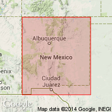
Summary:
Log Springs Formation is present in Nacimiento Mountains, where type section is measured in Pinos and Penasco Canyons, Sandoval Co, NM, San Juan basin. Log Springs contains no recognizable fossils; lies unconformably on beds of Arroyo Penasco Formation possibly as young as Meramec (Late Mississippian) age, and is unconformably overlain and truncated by arenaceous carbonate rocks containing a Morrow (Early Pennsylvanian) fauna. At base of Log Springs the basal regolith, terra rossa, as well as some of the sandstone, may have been formed in Late Mississippian time. Thus the age of the Log Springs may be Late Mississippian and/or Early Pennsylvanian. Unit was previously assigned a Morrow (Early Pennsylvanian) age by Armstrong (1955) based on stratigraphic position. Measured sections, diagrammatic correlation chart, fossil lists.
Source: GNU records (USGS DDS-6; Denver GNULEX).
- Usage in publication:
-
- Log Springs Formation*
- Modifications:
-
- Revised
- Age modified
- Biostratigraphic dating
- AAPG geologic province:
-
- San Juan basin
- Estancia basin
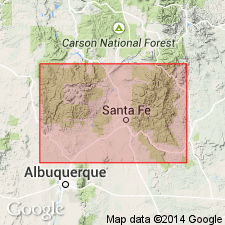
Summary:
Log Springs Formation revised--lower contact changed. Overlies with a marked unconformity various beds of Arroyo Penasco Group (rank raised to group in this report) in western part of report area, north-central NM. Underlies unnamed carbonate rocks which are in turn overlain by Sandia Formation, or in some places, Sandia Formation directly. Log Springs is present in sections measured at: San Pedro Mountain (Rio Arriba Co, San Juan basin); Pinos and Penasco Canyons, Nacimiento Mountains (Sandoval Co, San Juan basin); Guadalupe Box Canyon, Jemez Mountains (Sandoval Co, San Juan basin); and Placitas, Sandia Mountains (Bernalillo and Sandoval Cos, Estancia and San Juan basins). Age modified--in previous report by Armstrong (1967) Log Springs was assigned a Late Mississippian and/or Early Pennsylvanian age, but is here assigned to the Chesterian (Late Mississippian). This age is based on the fact that Log Springs' clastic red beds are post-Zone 16j [microfossil assemblage], and since it is overlain with hiatus by Zone 20, it must be a Chesterian-age equivalent. Correlation chart, measured sections.
Source: GNU records (USGS DDS-6; Denver GNULEX).
- Usage in publication:
-
- Log Springs Formation
- Modifications:
-
- Revised
- AAPG geologic province:
-
- San Juan basin
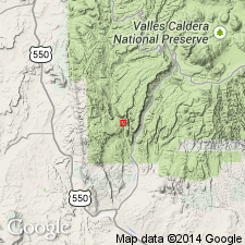
Summary:
Log Springs Formation revised in that it is now overlain by Osha Canyon Formation (newly named, this report). Osha Canyon occurs in several locations in southern Nacimiento and Jemez Mountains, including Pinos and Penasco Canyons and several places in and near Guadalupe Box (all in Sandoval Co, NM, San Juan basin); not observed outside this area. Osha Canyon overlies Log Springs Formation unconformably and underlies Sandia Formation unconformably at type section (at Guadalupe Box); in Pinos and Penasco Canyons overlies Log Springs with angular unconformity and underlies Madera Formation with sharp angular unconformity--Sandia Formation is absent here. Osha Canyon not reported in San Pedro or Sandia Mountains. The fossiliferous Osha Canyon is of Morrowan--probably late Morrowan (Early Pennsylvanian)--age, based on brachiopod fauna. Stratigraphic chart.
Source: GNU records (USGS DDS-6; Denver GNULEX).
- Usage in publication:
-
- Log Springs Formation*
- Modifications:
-
- Areal extent
- AAPG geologic province:
-
- San Juan basin
Summary:
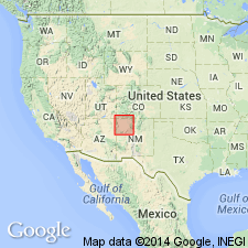
Log Springs Formation in the Nacimiento Mountains of NM, San Juan basin is lithologically similar to the Coalbank Hill Member and middle member of the Molas Formation of the northern part of the San Juan basin. The lower strata of the Log Springs are a regolith on carbonate rocks of the Arroyo Penasco Group. Basal Molas to the north is a regolith on Leadville Limestone. Log Springs is inferred to be Late Mississippian on basis of position between dated units. The Molas and Log Springs are shown together on an isopach map; a line of demarcation between the two units is drawn in northwest Sandoval Co., NM. Southeast of this line, the Log Springs shown as thickening to 100+ ft. Northwest of this line, the Molas thickens irregularly to 100+ ft. Molas extends northward into Black Mesa and Paradox basins. Correlation chart. Cross sections. Map unit --Log Springs and Molas considered Mississippian and Pennsylvanian age.
Source: GNU records (USGS DDS-6; Denver GNULEX).
For more information, please contact Nancy Stamm, Geologic Names Committee Secretary.
Asterisk (*) indicates published by U.S. Geological Survey authors.
"No current usage" (†) implies that a name has been abandoned or has fallen into disuse. Former usage and, if known, replacement name given in parentheses ( ).
Slash (/) indicates name conflicts with nomenclatural guidelines (CSN, 1933; ACSN, 1961, 1970; NACSN, 1983, 2005, 2021). May be explained within brackets ([ ]).

