

- Usage in publication:
-
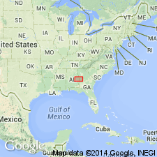
- Loachapoka Schist
- Modifications:
-
- Named
- Dominant lithology:
-
- Schist
- AAPG geologic province:
-
- Piedmont-Blue Ridge province
Summary:
Loachapoka Schist of Opelika Complex is named for town in Lee Co., AL. The Loachapoka and the Auburn Gneiss-schist, the other component of the Opelika Complex, represent a metagraywacke-pelite sequence deposited in varying sedimentary environments. The Loachapoka is composed of kyanite-sillimanite aluminous schist interlayered with thin metaorthoquartzite. Kyanite is the dominant alumino-silicate in the southwestern outcrop areas. Kyanite and sillimanite occur together north of Opelika, and sillimanite is the dominant alumino-silicate northeastward into GA. Thin amphibolite occurs locally. The Loachapoka is a relatively narrow lithologic unit in AL, but is much more extensive in western GA.
Source: GNU records (USGS DDS-6; Reston GNULEX).
- Usage in publication:
-
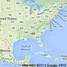
- Loachapoka Schist
- Modifications:
-
- Principal reference
- AAPG geologic province:
-
- Piedmont-Blue Ridge province
Summary:
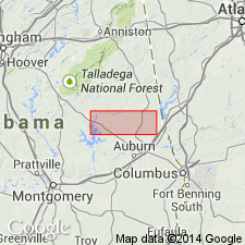
Loachapoka Schist rocks exposed in the study area are predominantly metapelite and graphitic schist, minor quartzite, and thin amphibolite intruded by numerous small pegmatites and larger bodies of granite including the Farmville Metagranite (named) and the associated Notasulga metagranite (informally named). Reference sections for the quartzites and schists within the Loachapoka are designated along an unpaved road in the western half of sec. 35, T20N, R25E, northwest Lee Co. Saugahatchee quartzite member of Sears and others (1981) is here referred to informally as Saugahatchee quartzite.
Source: GNU records (USGS DDS-6; Reston GNULEX).
- Usage in publication:
-
- Loachapoka Schist
- Modifications:
-
- Revised
- AAPG geologic province:
-
- Piedmont-Blue Ridge province
Summary:
Lithologic units that compose the Jacksons Gap Group do not disappear beneath the Coastal Plain as previously thought, but can be mapped eastward around the hinge zone of the Tallassee synform where along the eastern limb they become the Loachapoka Schist of the Opelika Complex. The Loachapoka continues along the east limb of the synform into GA where it corresponds to the Sandy Springs thrust sheet of Higgins and others (1988). The Saugahatchee quartzite of the Loachapoka Schist, the Tallassee and Devils Backbone quartzites of the Jacksons Gap Group, and the Chattahoochee Palisades Quartzite are correlative. Authors suggest that the name Chattahoochee Palisades Quartzite be applied to these quartzites and further recommend that the schists of the Loachapoka and Jacksons Gap Group be referred to as the Factory Shoals Formation of the Sandy Springs Group.
Source: GNU records (USGS DDS-6; Reston GNULEX).
- Usage in publication:
-
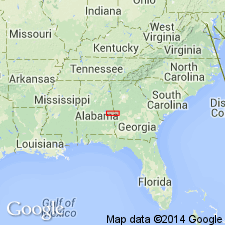
- Loachapoka Schist*
- Modifications:
-
- Overview
- AAPG geologic province:
-
- Piedmont-Blue Ridge province
Summary:
Inner Piedmont is divided into two groups of rocks, Dadeville and Opelika Complexes (Bentley and Neathery, 1970), divided by Stonewall line. Dadeville Complex consists of Agricola Schist, Waresville Schist, Camp Hill Gneiss, Chattasofka Creek Gneiss, Ropes Creek Amphibolite, Waverly Gneiss, Simmons Crossroads metagranite (informal), and various unnamed mafic and ultramafic intrusive rocks. Opelika Complex consists of Loachapoka Schist, Saugahatchee quartzite, and Auburn Gneiss and schist. Farmville Metagranite intrudes these units. Age of all Inner Piedmont rocks is early Paleozoic. Report includes geologic sketch map.
[Remark reflects usage as published, not as reviewed in draft form. Although GNU review requested informal terms to be inverted, the published version shows that authors did not comply with request. Whatley Mill is misspelled as Whatley Mills in published version; error introduced after GNU review. (GNU records, USGS DDS-6; Reston GNULEX 01/21/94)]
Source: GNU records (USGS DDS-6; Reston GNULEX).
For more information, please contact Nancy Stamm, Geologic Names Committee Secretary.
Asterisk (*) indicates published by U.S. Geological Survey authors.
"No current usage" (†) implies that a name has been abandoned or has fallen into disuse. Former usage and, if known, replacement name given in parentheses ( ).
Slash (/) indicates name conflicts with nomenclatural guidelines (CSN, 1933; ACSN, 1961, 1970; NACSN, 1983, 2005, 2021). May be explained within brackets ([ ]).