The National Geologic Map Database is migrating to a new infrastructure. We apologize for any service disruptions during this process.
|
|---|


- Usage in publication:
-
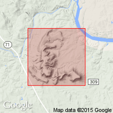
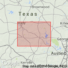
- Llano group
- Modifications:
-
- Original reference
- AAPG geologic province:
-
- Llano uplift
Summary:
Llano group. Local name Llano group is proposed from the best exposures of the group occurring in the county of Llano, central Texas. Outcrops also occur in Burnet, Mason, San Saba, Blanco and Gillespie Counties. Unconformably underlies Cambrian Potsdam group.
(See USGS Bull. 769, USGS geol. time classification, 1925, p. 120-121.)
The finest exposure seen, in direct contact with the base of the Texas Potsdam group, is along the western base of Packsaddle Mountain, in Llano County. Here the massive reddish colored sandstones of the Potsdam strike north and south wih a slight dip to the eastward, and rest on alternating beds of shale, sandy shales, sandstone, limestone and schists, that strike east and west, dipping south 15 to 40 degrees. The strata exhibit but little evidence of metamorphism, being indurated but little more than the beds of the overlying Potsdam and Carboniferous. The sections shows the Llano and Potsdam group unaffected by changes subsequent to the consolidation of the Potsdam sediments.
Source: USGS geologic time classification (USGS Bull. 769, p. 120-121).
- Usage in publication:
-
- Llano
- Modifications:
-
- Llano series
Summary:
Pg. 252, 276-282. Llano series. Assigned the Llano rocks to the "Eparchean group of the United States geologists," and stated that he considered them equivalent to a portion of the Algonkian system.
Source: USGS geologic time classification (USGS Bull. 769, p. 120-121).
For more information, please contact Nancy Stamm, Geologic Names Committee Secretary.
Asterisk (*) indicates published by U.S. Geological Survey authors.
"No current usage" (†) implies that a name has been abandoned or has fallen into disuse. Former usage and, if known, replacement name given in parentheses ( ).
Slash (/) indicates name conflicts with nomenclatural guidelines (CSN, 1933; ACSN, 1961, 1970; NACSN, 1983, 2005, 2021). May be explained within brackets ([ ]).