The National Geologic Map Database is migrating to a new infrastructure. We apologize for any service disruptions during this process.
|
|---|


- Usage in publication:
-
- Livingstone formation
- Modifications:
-
- First used
- AAPG geologic province:
-
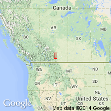
- Alberta trough
Summary:
Overlies Banff formation. Underlies Mount Head formation of the Rundle group. Is lowest formation (of two) of Rundle group. Is divided into Pekisko (new) and Turner Valley (new) members. First use here as formation with descriptions of composite outcrop and subsurface sections in southern Foothills of Alberta, Canada, in Alberta trough. Thickness 600 to 1,005 feet. Age is given as Carboniferous.
[The Rundle, Pekisko, and Turner Valley geologic units are not included in this lexicon. Please see the Lexicon of Canadian geologic units (WEBLEX), http://cgkn1.cgkn.net/weblex/weblex_e.pl, for information on these.]
Source: GNU records (USGS DDS-6; Denver GNULEX).
- Usage in publication:
-
- Livingstone Formation
- Modifications:
-
- Overview
- Areal extent
- AAPG geologic province:
-
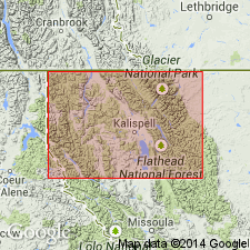
- Montana folded belt
Summary:
Overlies Banff Formation. Underlies Salter Member of Mount Head Formation. Is basal unit of Rundle Group, which includes (ascending): Livingstone, Mount Head, and Etherington Formations. Is extended into northeastern Whitefish Range, northeastern Flathead Co, MT in the Montana folded belt province. Occurs as brecciated and recrystallized carbonate. Thickness estimated to be 1,500 ft. Age given as Mississippian.
Source: GNU records (USGS DDS-6; Denver GNULEX).
For more information, please contact Nancy Stamm, Geologic Names Committee Secretary.
Asterisk (*) indicates published by U.S. Geological Survey authors.
"No current usage" (†) implies that a name has been abandoned or has fallen into disuse. Former usage and, if known, replacement name given in parentheses ( ).
Slash (/) indicates name conflicts with nomenclatural guidelines (CSN, 1933; ACSN, 1961, 1970; NACSN, 1983, 2005, 2021). May be explained within brackets ([ ]).