The National Geologic Map Database is migrating to a new infrastructure. We apologize for any service disruptions during this process.
|
|---|


- Usage in publication:
-
- Liveoak member
- Modifications:
-
- Named
- Dominant lithology:
-
- Sandstone
- Silt
- AAPG geologic province:
-
- Transverse Ranges province
Summary:
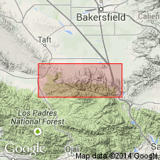
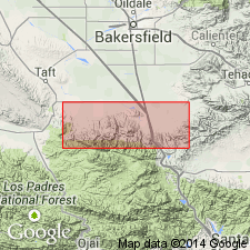
Named as second from lowest member of Tejon Formation. Type locality designated as Liveoak Canyon on north slope of Tehachapi Mountains in type area of Tejon Formation. Stratigraphic relations to other members of Tejon established in Grapevine Canyon where unit underlies Metralla sandstone member and overlies Uvas conglomerate member (both new and of Tejon formation). Consists of 1970 ft of sandstones and silt. Includes FICOPSIS HORNII, TURRITELLA BUWALDANA, T. NEOPLEURA, T. UVASANA, WHITNEYELLA SINUATA. Age is Eocene based on fossils.
Source: GNU records (USGS DDS-6; Menlo GNULEX).
- Usage in publication:
-
- Liveoak member
- Modifications:
-
- Age modified
- AAPG geologic province:
-
- Transverse Ranges province
Summary:
Consists of coarse-grained sediments in lower half and of alternating fine-grained sandstone, silts, and shales in upper half. Conformably overlies Uvas conglomerate member in Grapevine Canyon; rests upon granitic terrane in all other parts of area by either unconformable or fault contact. In its type locality Liveoak is only representative of Tejon formation and lies unconformably beneath Tecuya formation. Assigned tentatively to late middle Eocene age.
Source: GNU records (USGS DDS-6; Menlo GNULEX).
- Usage in publication:
-
- Liveoak Shale Member*
- Modifications:
-
- Adopted
- Redescribed
- Dominant lithology:
-
- Sandstone
- Shale
- AAPG geologic province:
-
- Transverse Ranges province
Summary:
Liveoak Member of Marks (1941) is redescribed as Liveoak Shale Member of Tejon Formation. Is generally sandier in its lower and upper portions and grades eastward from deep-water shale to shallow shelf-type silty shales and eventually wedges out into shallow marine transgressive and regressive sandstones. Thickness ranges from 0 to 2000 ft. Age is Eocene.
Source: GNU records (USGS DDS-6; Menlo GNULEX).
- Usage in publication:
-
- Liveoak Shale Member*
- Modifications:
-
- Overview
- Age modified
- Revised
- AAPG geologic province:
-
- Transverse Ranges province
Summary:
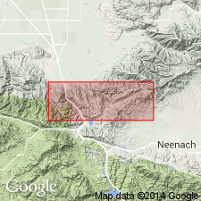
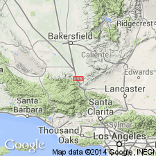
Measured type section (470 ft) stratigraphically restricted to exclude rocks assigned to Uvas Conglomerate and Metralla Sandstone Members. Is designated at east side of and about 2/3 mi south of mouth of Liveoak Canyon in S/4 sec.23 T10N R19W Grapevine 7.5' quad, Kern Co, CA. Consists generally of thick (0 to 2000 ft) of monotonous sequence of laminated to massive shale and mudstone containing interlaminated siltstone. Called "worm-impression siltstone" because extensively bioturbated. Shown on geologic map of San Emigdio and western Tehachapi Mountains. Age is early and middle Eocene on basis of Penutian and Narizian fossils.
Source: GNU records (USGS DDS-6; Menlo GNULEX).
For more information, please contact Nancy Stamm, Geologic Names Committee Secretary.
Asterisk (*) indicates published by U.S. Geological Survey authors.
"No current usage" (†) implies that a name has been abandoned or has fallen into disuse. Former usage and, if known, replacement name given in parentheses ( ).
Slash (/) indicates name conflicts with nomenclatural guidelines (CSN, 1933; ACSN, 1961, 1970; NACSN, 1983, 2005, 2021). May be explained within brackets ([ ]).