The National Geologic Map Database is migrating to a new infrastructure. We apologize for any service disruptions during this process.
|
|---|


- Usage in publication:
-
- Livengood Dome Chert*
- Modifications:
-
- Named
- Reference
- Dominant lithology:
-
- Chert
- Shale
- Argillite
- AAPG geologic province:
-
- Alaska East-Central region
Summary:
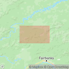
Type area designated as exposures between valleys of Lost Creek and South Fork of Hess Creek, Livengood C-4 quad, AK. Reference section in borrow pit 13.6 km west of town of Livengood and 2.4 km west of Lost Creek, SW 1/4 sec.8 T8N R6W. Rocks of Livengood Dome Chert and unnamed unit formerly were unnamed lower and upper units of Livengood Chert of Mertie (1937) which has been abandoned. Composed of light-gray to grayish-black (weathering gray, green, yellow, reddish-brown or red) chert with interbedded shale, argillite, and siltstone. Is thick- to thin-bedded, jointed, and brecciated. Forms complex structure with overturned folds and faults. Shale is fossiliferous (graptolites). Thickness ranges from 300 to 600 m. Unconformably overlies Precambrian(?) or Cambrian rocks; underlies Middle Silurian to Early Devonian unnamed dolomite and limestone unit. Is Late Ordovician age.
Source: GNU records (USGS DDS-6; Menlo GNULEX).
For more information, please contact Nancy Stamm, Geologic Names Committee Secretary.
Asterisk (*) indicates published by U.S. Geological Survey authors.
"No current usage" (†) implies that a name has been abandoned or has fallen into disuse. Former usage and, if known, replacement name given in parentheses ( ).
Slash (/) indicates name conflicts with nomenclatural guidelines (CSN, 1933; ACSN, 1961, 1970; NACSN, 1983, 2005, 2021). May be explained within brackets ([ ]).