


- Usage in publication:
-
- Little Oak limestone*
- Modifications:
-
- Named
- Dominant lithology:
-
- Limestone
- Chert
- AAPG geologic province:
-
- Appalachian basin
Summary:
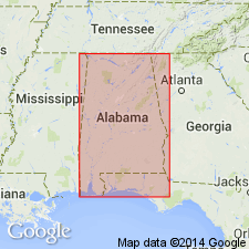
Little Oak limestone is generally thick-bedded dark, rather coarsely crystalline limestone, in places containing many chert nodules. At top a considerable portion of the formation is very argillaceous. Thickness ranges 0 to 500 ft. Unconformably overlies Athens shale. Occurs in Cahaba Valley, north-central AL. Fossils of latest Chazy (Early Ordovician) age.
Source: GNU records (USGS DDS-6; Reston GNULEX).
- Usage in publication:
-
- Little Oak limestone
- Modifications:
-
- Overview
- AAPG geologic province:
-
- Appalachian basin
Summary:
Little Oak consists of thick-bedded dark nodular limestone with nodular chert. In St. Clair Co., contains two layers of metabentonite. Maximum thickness 500 ft. Near Siluria, thinned edge of formation rests on black shale of Columbiana formation. Along Cahaba Valley, thickens enormously and rests on Lenoir formation. Age is Middle Ordovician (late Chazyan).
Source: GNU records (USGS DDS-6; Reston GNULEX).
- Usage in publication:
-
- Little Oak Limestone
- Modifications:
-
- Overview
- AAPG geologic province:
-
- Appalachian basin
Summary:
Primary difference between the Little Oak and the conformably underlying Lenoir Limestone with which it is mapped in this report, is the general abundance of fossil fragments and whole fossils in the Little Oak. The fauna includes brachiopods, gastropods, pelmatozoans, corals, sponges, ostracodes, algae, and graptolites. Unit is well exposed in an abandoned quarry on the northwest side of Little Oak Ridge at Pelham (NE1/4SE1/4 sec. 12, T20S, R3W). Age is poorly constrained. Little is known about the age of the lower part of the unit which is generally poorly exposed. Conodonts from the middle of the Little Oak indicate that unit is no younger than Chazyan (Hall and others, 1986). However, conodonts from the bentonite layers at Ragland indicate a Porterfieldian (Blackriveran) age for the upper part according to Drahovzal and Neathery, 1971). Uppermost part of the Litte Oak may not be present in the Cahaba Valley. Contact with the underlying Lenoir is very gradational. No thickness was determined for either unit for this report, but a composite thickness for both units ranges from approximately 900 ft at Pelham to 1100 ft at the northeast end of the study area.
Source: GNU records (USGS DDS-6; Reston GNULEX).
For more information, please contact Nancy Stamm, Geologic Names Committee Secretary.
Asterisk (*) indicates published by U.S. Geological Survey authors.
"No current usage" (†) implies that a name has been abandoned or has fallen into disuse. Former usage and, if known, replacement name given in parentheses ( ).
Slash (/) indicates name conflicts with nomenclatural guidelines (CSN, 1933; ACSN, 1961, 1970; NACSN, 1983, 2005, 2021). May be explained within brackets ([ ]).