- Usage in publication:
-
- Little Falls Formation
- Modifications:
-
- Named
- Dominant lithology:
-
- Slate
- Phyllite
- Schist
- AAPG geologic province:
-
- Lake Superior region
Summary:
Name Little Falls Formation applied to argillaceous rocks in Mille Lacs Group (new). Is dominantly medium- to light-gray argillaceous material, now slate, phyllite, or finely crystalline schist intercalated with thin beds of metasiltstone and quartzose metagraywacke. Differs from underlying Denham Formation (new) by containing sandstones of wacke, rather than of arenitic affinity. Differs and is not correlative with Thomson Formation due to fact that (1) Little Falls strata are infolded with lower Precambrian gneissic rocks, implying that they are stratigraphically near base of the middle Precambrian sequence; and (2) subsurface and geophysical data indicate Little Falls strata pass northward transitionally into strata of Randall Formation (new), which unequivocally overlie lower Precambrian basement rocks. Underlies Glen Township (new) Formation. Age is middle Precambrian. Report includes geologic map.
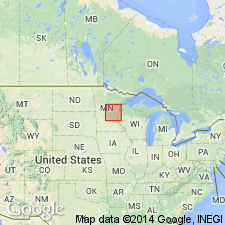
Type locality: on and near Mill Island, in valley of Mississippi River near center of city of Little Falls (in sec. 8, T. 41 N., R. 32 W., and sec. 19, T. 129 N., R. 32 W.), Morrison Co., MN, in the Lake Superior region. Other exposures occur at "Blanchard Dam locality," in NE/4 NW/4 sec. 32, T. 128 N., R. 29 W., and along Elk River, in sec. 5, T. 129 W., R. 29 W.
Source: Modified from GNU records (USGS DDS-6; Denver GNULEX).
For more information, please contact Nancy Stamm, Geologic Names Committee Secretary.
Asterisk (*) indicates published by U.S. Geological Survey authors.
"No current usage" (†) implies that a name has been abandoned or has fallen into disuse. Former usage and, if known, replacement name given in parentheses ( ).
Slash (/) indicates name conflicts with nomenclatural guidelines (CSN, 1933; ACSN, 1961, 1970; NACSN, 1983, 2005, 2021). May be explained within brackets ([ ]).

