

- Usage in publication:
-
- Little Elk gneissoid granite
- Modifications:
-
- Named
- Dominant lithology:
-
- Granite
- AAPG geologic province:
-
- Midcontinent region
Summary:
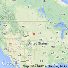
Named for exposures in valley of Little Elk Creek in northeastern part of Black Hills, Meade Co, SD in the Midcontinent region. No type locality designated. Has a hypautomorphic-equigranular texture in massive part. Cataclastic texture exhibited where large grains of quartz and feldspar have been fractured. Has veinlets of quartz, calcite, and muscovite. Foliated micaceous layers occur in mylonitic zones. Has an older quartz which occurs as large crystals and younger quartz that fills fractures in feldspar and in the older quartz. Feldspars are (in order of abundance); albite, microcline, perthite, and orthoclase. Quartz and feldspar were among the first minerals to form. After crystallization, mylonitic zones and micaceous layers formed and veinlets developed along fractures. Intruded pre-Cambrian sedimentary rocks. Age relative to age to Game Lodge granite (named) uncertain. Of pre-Cambrian age.
Source: GNU records (USGS DDS-6; Denver GNULEX).
- Usage in publication:
-
- Little Elk Granite*
- Modifications:
-
- Geochronologic dating
- AAPG geologic province:
-
- Midcontinent region
Summary:
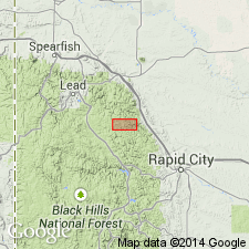
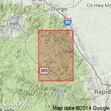
Was first crystallized 2,560 m.y. and disturbed about 60 m.y. Exposed over an area about 2 sq mi through 2 windows in Paleozoic sedimentary rocks. Geologic map shows occurrence of the granite in the Little Elk Canyon area of Meade and Lawrence Cos, SD, Midcontinent region. The zircon isotopic age of 2,560 m.y. makes Little Elk the oldest unit yet identified in the Black Hills.
Source: GNU records (USGS DDS-6; Denver GNULEX).
- Usage in publication:
-
- Little Elk Granite*
- Modifications:
-
- Revised
- AAPG geologic province:
-
- Midcontinent region
Summary:
Mapped in two separate exposures--one near Little Elk Canyon in Meade and Lawrence Cos, SD; the other east of Dalton Lake in Lawrence Co, SD--in the Midcontinent region. Revised in that it unconformably underlies the middle Precambrian Boxelder Creek Quartzite (new) of the Nemo Group (revised). Is chiefly a gneissic granite and some plagioclase-quartz-biotite gneiss, and some dark paragneiss. Is approximately 2.5 b.y. old, or early Precambrian.
Source: GNU records (USGS DDS-6; Denver GNULEX).

- Usage in publication:
-
- Little Elk Granite*
- Modifications:
-
- Age modified
- AAPG geologic province:
-
- Midcontinent region
Summary:
Has a U-Th-Pb zircon date of 2.51 +/-0.7 Ga (recalculated from Zartman and Stern, 1967), thereby giving it a Late Archean age. Intrudes the Nemo Iron-formation. Geologic map.
Source: GNU records (USGS DDS-6; Denver GNULEX).
For more information, please contact Nancy Stamm, Geologic Names Committee Secretary.
Asterisk (*) indicates published by U.S. Geological Survey authors.
"No current usage" (†) implies that a name has been abandoned or has fallen into disuse. Former usage and, if known, replacement name given in parentheses ( ).
Slash (/) indicates name conflicts with nomenclatural guidelines (CSN, 1933; ACSN, 1961, 1970; NACSN, 1983, 2005, 2021). May be explained within brackets ([ ]).