- Usage in publication:
-
- Little Eagle lithofacies
- Modifications:
-
- Named
- Biostratigraphic dating
- Dominant lithology:
-
- Silt
- Shale
- Sand
- AAPG geologic province:
-
- Williston basin
Summary:
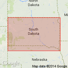
Named eastward facies (Maestrichtian) and informal division of Trail City Member, lower member of Upper Cretaceous Fox Hills Formation, for exposures on north side of Grand River north and west of village of Little Eagle, Corson Co, SD, Williston basin. Type section on south-facing bluff SW1/4 sec 26, T20N, R26E, where Little Eagle: 77 ft thick; overlies Elk Butte Member of Pierre Shale; underlies Timber Lake Member of Fox Hills. Consists (ascending): 1) gray silty shale with layer of scattered flat-ovoid concretions with gray silty limestone cores and gray calcareous silt jackets, and fossils (Lower NICOLLETI Assemblage Zone); 2) gray silty shale with scattered concretions and fossils (LIMOPSISGERVILLIA and NICOLLETI Assemblage zones); 3) two very fine to fine grained, clayey to silty glauconitic sands separated by ledge formed by concretions ovoid to irregular and fossiliferous (PROTOCARDIAOXYTOMA Assemblage Zone); 4) silty to sandy shale with plant fragments; 5) clayey silt and sand separated by concretionary layer; 7) shaly, bentonitic sand in type measured section. Jarosite blebs scattered in lower 34 ft. Cross sections; facies map; nomenclature chart; measured reference sections. Distinctive concretion layers so worked by burrowing organisms that bedding structure mostly obliterated. 65-100 ft thick. Present east part of Fox Hills type area. To west passes into Irish Creek lithofacies (new) of Trail City in Grand River valley.
Source: GNU records (USGS DDS-6; Denver GNULEX).
For more information, please contact Nancy Stamm, Geologic Names Committee Secretary.
Asterisk (*) indicates published by U.S. Geological Survey authors.
"No current usage" (†) implies that a name has been abandoned or has fallen into disuse. Former usage and, if known, replacement name given in parentheses ( ).
Slash (/) indicates name conflicts with nomenclatural guidelines (CSN, 1933; ACSN, 1961, 1970; NACSN, 1983, 2005, 2021). May be explained within brackets ([ ]).

