

- Usage in publication:
-
- Little Cedar Formation
- Modifications:
-
- Named
- Dominant lithology:
-
- Dolomite
- Limestone
- Shale
- AAPG geologic province:
-
- Iowa shelf
- Wisconsin arch
- Lincoln anticline
- Illinois basin
Summary:
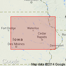
Named as the basal formation (of 4) of Cedar Valley Group (rank raised) for exposures in Chickasaw Park Quarry, N1/2 NW NE sec 21, T95N, R14W, adjacent to Little Cedar River in southwestern Chickasaw Co, IA on the Iowa shelf. Disconformably overlies Davenport Member of Pinicon Ridge Formation. Underlies Coralville Formation of Cedar Valley Group. Ranges between 15 to 37 m thick. Is thinnest in southeast IA and thickest in northern and central IA. Is dominated by fossiliferous limestone in east-central and southeast IA, and northern IL. Is characterized by fossiliferous dolomite and dolomitic limestone in lower part and by sparsely fossiliferous to nonfossiliferous dolomite, shale, and limestone, gypsum, anhydrite in upper part in northern and central IA. Thought to have been deposited during a large scale transgressive-regressive cycle. Divided into the (ascending) Solon and Rapid Members in east-central IA and into the Solon, Bassett, Chickasaw Shale, Eagle Center, and Hinkle Members in northern IA and southeastern MN on the Iowa shelf. The Rapid and Solon Members extend into IL in the [Illinois basin? and Wisconsin arch?] and MO on the Lincoln anticline. Of Middle Devonian age. Graphic lithologic sections; nomenclature charts; cross sections.
Source: GNU records (USGS DDS-6; Denver GNULEX).
For more information, please contact Nancy Stamm, Geologic Names Committee Secretary.
Asterisk (*) indicates published by U.S. Geological Survey authors.
"No current usage" (†) implies that a name has been abandoned or has fallen into disuse. Former usage and, if known, replacement name given in parentheses ( ).
Slash (/) indicates name conflicts with nomenclatural guidelines (CSN, 1933; ACSN, 1961, 1970; NACSN, 1983, 2005, 2021). May be explained within brackets ([ ]).