

- Usage in publication:
-
- Lithograph City Formation
- Modifications:
-
- Named
- Dominant lithology:
-
- Dolomite
- Limestone
- AAPG geologic province:
-
- Iowa shelf
Summary:
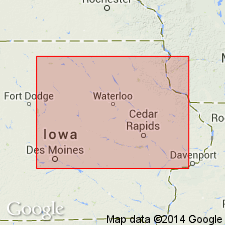
Named as a formation of Cedar Valley Group (raised in rank); named for the town of Lithograph City, Floyd Co, IA, Iowa shelf. Formerly called Unit C by Witzke and Bunker (1985). Type locality designated at the former site of Lithograph City in SW NE sec 26, T97N, R17W in Floyd Co. Occurs in northern, southeastern, and central IA. Was deposited during a major transgressive-regressive depositional cycle. Lower transgressive part consists of vuggy fossiliferous dolomite and dolomitic limestones; upper regressive part consists of unfossiliferous laminated to intraclastic limestone and dolomite, with dense lithographic and sublithographic limestones locally prominent. Thickness varies from 80-100 ft across northern IA. In north-central and central IA, is subdivided into three members (all new) (ascending)--Osage Springs Member, Thunder Woman Shale, and Idlewild Member. Two additional units in east-central and southeast IA also assigned member status--State Quarry Member and Andalusia Member (new). Andalusia probably extends into northwest IL area on the Wisconsin arch. Underlies Shell Rock Formation of Cedar Valley Group; overlies "Unit B" of Cedar Valley Group. Cross sections; measured sections; graphic sections. Fossil lists (primarily brachiopods and conodonts). Middle-Late Devonian boundary falls at some undefinable point within the Lithograph City Formation.
Source: GNU records (USGS DDS-6; Denver GNULEX).
- Usage in publication:
-
- Lithograph City Formation
- Modifications:
-
- Named
- Reference
- Dominant lithology:
-
- Limestone
- Shale
- Dolomite
- AAPG geologic province:
-
- Iowa shelf
- Lincoln anticline
- Illinois basin
Summary:
Named as formation (1 of 4) of Cedar Valley Group (revised). Formerly assigned to part of Coralville Member of Cedar Valley Formation or to unit C of Cedar Valley Group. Nomenclature charts, cross section, graphic sections. Type locality is in old quarry adjacent to former town of Lithograph City, SW NE sec 26, T97N, R17W, Floyd Co, IA. Only Idlewild Member (new) shown at Lithograph City type. A complete subsurface reference section designated in FM-4 core, SW NW SE sec 31, T96N, R18W, where Lithograph City unconformably overlies Coralville Formation (revised) and underlies Shell Rock Formation (revised) of Cedar Valley Group. In northern IA, Iowa shelf, it includes limestone, shale, and dolomite, is variably fossiliferous, laminated, or brecciated. Evaporites present in central IA (Iowa shelf). Is predominantly fossiliferous limestone, dolomite, and shale in southeast IA (Iowa shelf). Divisible into Osage Springs, Thunder Woman Shale, and Idlewild Members in northern IA. Andalusia Member named and identified in eastern IA (Iowa shelf), northeast MO (Lincoln anticline), western IL (Illinois basin). State Quarry Member (rank reduced) assigned in east IA (Iowa shelf). Ranges from 20-36 m thick, but is thinner (0-12 m) to southeast. Of late Givetian, Middle Devonian-conodont INSITA-to Frasnian, Late Devonian-conodont ASYMMETRICUS Subzone.
Source: GNU records (USGS DDS-6; Denver GNULEX).
For more information, please contact Nancy Stamm, Geologic Names Committee Secretary.
Asterisk (*) indicates published by U.S. Geological Survey authors.
"No current usage" (†) implies that a name has been abandoned or has fallen into disuse. Former usage and, if known, replacement name given in parentheses ( ).
Slash (/) indicates name conflicts with nomenclatural guidelines (CSN, 1933; ACSN, 1961, 1970; NACSN, 1983, 2005, 2021). May be explained within brackets ([ ]).