The National Geologic Map Database is migrating to a new infrastructure. We apologize for any service disruptions during this process.
|
|---|


- Usage in publication:
-
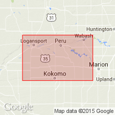
- Liston Creek limestone
- Modifications:
-
- Named
- Dominant lithology:
-
- Limestone
- AAPG geologic province:
-
- Cincinnati arch
Summary:
Name Liston Creek limestone introduced here for a series of thin slabby limestone beds with considerable associated chert, 26 ft thick along Liston Creek, Wabash Co. Lower part is slabby and contains less chert than upper part. Top of formation unknown. In a few outcrops a drusy brown or yellow very fossiliferous dolomite is associated with the Liston Creek. Exact position of this dolomite is not certain. It may represent an overlying formation distinct from the Liston Creek, or it may be only a local development of it found only adjacent to the coral reefs. Niagaran fossils are found sparingly throughout. Rests on Red Bridge limestone.
Source: GNU records (USGS DDS-6; Reston GNULEX).
- Usage in publication:
-
- Liston Creek formation
- Modifications:
-
- Revised
- AAPG geologic province:
-
- Cincinnati arch
Summary:
Liston Creek formation, as here defined consists of the strata lying conformably between top of Mississinewa shale and base of overlying Huntington dolomite. Formation consists of Red Bridge limestone member, a local bed (0 to 12 t thick) at base, and the Liston Creek limestone (up to 60 ft thick) at top. Good exposures at mouth of Liston Creek, Wabash Co., where the limestone is 28 ft thick. Where Red Bridge limestone member thins out there is no evidence of disconformity between Liston Creek limestone member and underlying Mississinewa shale. Along Pipe Creek, 0.5 mi northwest of Bunker Hill, the Liston Creek limestone is disconformably overlain by Devonian limestones. Authors believe Louisville limestone is represented in Liston Creek formation. Age is Silurian (Niagaran).
Source: GNU records (USGS DDS-6; Reston GNULEX).

- Usage in publication:
-
- Liston Creek Limestone Member
- Modifications:
-
- Overview
- AAPG geologic province:
-
- Cincinnati arch
Summary:
At type section on Liston Creek, which is now under water, Liston Creek Limestone Member of Wabash Formation consists of about 30 ft of cherty limestone and dolomitic limestone that is light gray and tan, fine- to medium-grained, fossil fragmental, and slabby bedded. Conformably(?) overlies the Mississinewa Shale Member, also of Wabash Formation. Elsewhere, unit is more than 100 ft. Unit extends into southwestern Indiana in the subsurface where it has a vertical cutoff against rocks in the upper part of the Bainbridge Group. The Huntington lithofacies, a reef facies, continues upward without a break from the Mississinewa into the Liston Creek and these three lithologies are so intermixed in many areas that the members are not separable. Typically, the Liston Creek contains the glauconitic Red Bridge Limestone Bed at its base. Unconformably underlies Middle Devonian rocks or locally, the Kokomo Member. Nearly equivalent to the Bailey Limestone in the Illinois basin parts of IN, KY, and IL. Corresponds to the upper Racine rocks in northern IL and eastern WI, to upper Salina rocks in the Michigan and Appalachian basins, and to Salina rocks above the Vernon Shale in NY. Characterized by the conodonts POLYGNATHOIDES SILURICUS, SPATHOGNATHODUS PRIMUS, and S. EOSTEINHORNENSIS, indicating a Late Silurian, late Ludlovian to Pridolian (Cayugan), age.
Source: GNU records (USGS DDS-6; Reston GNULEX).
For more information, please contact Nancy Stamm, Geologic Names Committee Secretary.
Asterisk (*) indicates published by U.S. Geological Survey authors.
"No current usage" (†) implies that a name has been abandoned or has fallen into disuse. Former usage and, if known, replacement name given in parentheses ( ).
Slash (/) indicates name conflicts with nomenclatural guidelines (CSN, 1933; ACSN, 1961, 1970; NACSN, 1983, 2005, 2021). May be explained within brackets ([ ]).