The National Geologic Map Database is migrating to a new infrastructure. We apologize for any service disruptions during this process.
|
|---|


- Usage in publication:
-
- Linton formation*
- Modifications:
-
- Named
- Dominant lithology:
-
- Sandstone
- Shale
- Coal
- AAPG geologic province:
-
- Illinois basin
Summary:
Linton formation (new name) consists of (ascending) 10 to 20 ft of sandstone and shale, Coal IIIa 8 in. thick, 2 to 5 ft of black fissile shale, 1.5 ft of limestone, 20 to 30 ft of sandstone and shale, and Coal IV, averaging 4 ft in thickness. Rests on Coal III or on 1 to 6 ft of gray shale overlying Coal III; lies above erosional unconformity cut into topmost beds of underlying Staunton formation; overlain by shale or sandstone of Petersburg formation.
Source: GNU records (USGS DDS-6; Reston GNULEX).
- Usage in publication:
-
- Linton Formation
- Modifications:
-
- Overview
- Reference
- AAPG geologic province:
-
- Illinois basin
Summary:
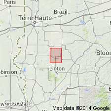
Indiana Geological Survey drillhole SDH 306 is herein designated the reference core for the Houchin Creek Coal Member of the Petersburg Formation; the Survant Coal, Velpen Limestone, Mecca Quarry Shale, and Colchester Coal Members of the Linton Formation; the Seelyville Coal Member of the Staunton Formation; and the boundary between the Petersburg and Linton Formations. SDH 306 is located near the type section of the Survant Coal Member, in SW1/4 NE1/4 sec. 2, T2S, R7W, Pike Co., southern IN. Core probably includes the basal boundary of the Linton Formation and Carbondale Group. However, the assignment of the lowest coal in SDH 306 to the Seelyville Coal Member is tentative and therefore the position of the base of the Linton is tentative.
Source: GNU records (USGS DDS-6; Reston GNULEX).
For more information, please contact Nancy Stamm, Geologic Names Committee Secretary.
Asterisk (*) indicates published by U.S. Geological Survey authors.
"No current usage" (†) implies that a name has been abandoned or has fallen into disuse. Former usage and, if known, replacement name given in parentheses ( ).
Slash (/) indicates name conflicts with nomenclatural guidelines (CSN, 1933; ACSN, 1961, 1970; NACSN, 1983, 2005, 2021). May be explained within brackets ([ ]).