- Usage in publication:
-
- Lindsey Bridge member
- Modifications:
-
- Named
- Dominant lithology:
-
- Limestone
- AAPG geologic province:
-
- Chautauqua platform
- Arkoma basin
Summary:
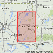
Name applied to the chert-pebble calcareous facies of the Moorefield formation, basal formation of Mayes group. Named (as 1 of 4 members of Moorefield) for development along north bank of Grand River in cliff east of Lindsey Bridge, sec. 6, T 20 N, R 20 E --its type locality--in southern Mayes Co., OK on the Chautauqua platform. Moorefield mapped, but members not separately mapped. Geologic maps (5) cover the following areas in the Arkoma basin and on the Chautauqua platform--1.) Vinita-Pensacola, 2.) Pryor-Salina, 3.) Hulbert-Parkhill, 4.) Tenkiller Ferry, and 5.) Stillwell. Consists of gray, medium crystalline, locally oolitic, cross-bedded calcarenite. Characterized by abundance of angular, white, tan, and blue chert fragments ranging in size from pebbles to microscopic specks. Size of chert fragments related to proximity of the Boone chert source area. Thickness varies from 0 to 245 ft. Overlies Bayou Manard member (newly named) of Moorefield; contact is transitional. Contact with overlying Ordnance Plant member (newly named) of Moorefield conformable. Sparingly fossiliferous. Fossils (brachiopods, mollusks, trilobites) listed. Many measured sections. Assigned to the [Upper] Mississippian, Meramecian series.
Source: GNU records (USGS DDS-6; Denver GNULEX).
For more information, please contact Nancy Stamm, Geologic Names Committee Secretary.
Asterisk (*) indicates published by U.S. Geological Survey authors.
"No current usage" (†) implies that a name has been abandoned or has fallen into disuse. Former usage and, if known, replacement name given in parentheses ( ).
Slash (/) indicates name conflicts with nomenclatural guidelines (CSN, 1933; ACSN, 1961, 1970; NACSN, 1983, 2005, 2021). May be explained within brackets ([ ]).

