The National Geologic Map Database is migrating to a new infrastructure. We apologize for any service disruptions during this process.
|
|---|


- Usage in publication:
-
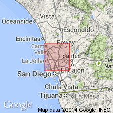
- Lindavista terrace material
- Modifications:
-
- Named
- Dominant lithology:
-
- Sand
- Gravel
- AAPG geologic province:
-
- Peninsular Ranges province
Summary:
[Probably named for Southern Pacific Lindavista railroad siding, La Jolla 15' quad, San Diego Co., CA]. Consists of fine and coarse arkosic sand, gravel, and well-rounded boulders that range in size to a foot or more. Color is prevailingly red and brown. Boulders are largely from the Eocene Poway conglomerate. Thickness averages less than 25 feet and is over 100 feet on beach ridges. Overlies the Poway conglomerate and San Diego formation. Is unfossiliferous. Age on map legend given as Quaternary.
Source: GNU records (USGS DDS-6; Menlo GNULEX).
- Usage in publication:
-
- Lindavista Formation*
- Modifications:
-
- Adopted
- AAPG geologic province:
-
- Peninsular Ranges province
Summary:
Lindavista Formation of Hanna (1926) is adopted. Named after the Lindavista railroad junction (32 deg 53'N, 117 deg 11'W) La Jolla 15' quad, San Diego Co., CA. Generally stands at altitude of 120 m in San Diego area; where cut by Rose Canyon fault, stands upward to 250 m. Is reddish-brown marine-terrace deposit, 2 to 10 m thick. Overlies the San Diego Formation of Pliocene age; underlies the Bay Point Formation of late Pleistocene age. Age is early Pleistocene based on stratigraphic relations.
Source: GNU records (USGS DDS-6; Menlo GNULEX).
- Usage in publication:
-
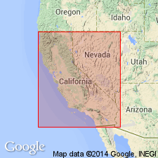
- Linda Vista Formation
- Modifications:
-
- Areal extent
- AAPG geologic province:
-
- Peninsular Ranges province
Summary:
Correlation chart shows that the Linda Vista Formation of Hanna (1926) is geographically extended to the west coast of the State of Baja California, Mexico (Minch, 1967). North of the border in the San Diego area, the Linda Vista Formation is shown as equivalent to the Sweitzer Formation of Hertlein and Grant (1939).
Source: GNU records (USGS DDS-6; Menlo GNULEX).
For more information, please contact Nancy Stamm, Geologic Names Committee Secretary.
Asterisk (*) indicates published by U.S. Geological Survey authors.
"No current usage" (†) implies that a name has been abandoned or has fallen into disuse. Former usage and, if known, replacement name given in parentheses ( ).
Slash (/) indicates name conflicts with nomenclatural guidelines (CSN, 1933; ACSN, 1961, 1970; NACSN, 1983, 2005, 2021). May be explained within brackets ([ ]).