The National Geologic Map Database is migrating to a new infrastructure. We apologize for any service disruptions during this process.
|
|---|


- Usage in publication:
-
- Limestone Gap shale
- Modifications:
-
- Named
- Dominant lithology:
-
- Shale
- AAPG geologic province:
-
- Ouachita folded belt
- South Oklahoma folded belt
Summary:
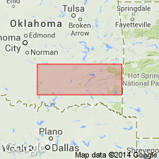
Named as a formation of Springer group of Morrow series of the Bendian period. Type locality designated at Limestone Gap (source of name), sec 31, T2N, R13E, Atoka Co, OK in the Ouachita tectonic belt province. Occurs in the frontal Ouachitas, Ardmore basin, and Arbuckle Mountains; in the Ouachitas, is well exposed along Choctaw fault zone; in Ardmore basin, is well developed; in Arbuckle Mountains, areal distribution is exceedingly spotty and not traceable. Consists of gray-greenish, dark gray, and black bituminous shale with a profusion of siderite layers and concretions. In Ardmore basin, upper part ordinarily is predominantly silty and finely arenaceous; lower part contains in a few places thin arenaceous streaks, also contains scattered drab argillaceous limestone concretions with many fine plant fragments. Thickness is 1,250 ft about 5 mi east of the village of Springer, in a tributary of Cool Creek, along railroad track near center of SE1/4 sec 1, T3S, R2E, Carter Co, OK; thickness at type locality is 44 ft. South of Arbuckles, north of Arbuckles, and in the frontal Ouachitas, overlies Primrose formation and underlies Wapanucka formation, both of Springer group of Morrow series of Bendian period. Fossils--conodonts, Foraminifera, ostracods, linguloid shells, pelecypods. Correlation chart. Of Carboniferous age.
Source: GNU records (USGS DDS-6; Denver GNULEX).
For more information, please contact Nancy Stamm, Geologic Names Committee Secretary.
Asterisk (*) indicates published by U.S. Geological Survey authors.
"No current usage" (†) implies that a name has been abandoned or has fallen into disuse. Former usage and, if known, replacement name given in parentheses ( ).
Slash (/) indicates name conflicts with nomenclatural guidelines (CSN, 1933; ACSN, 1961, 1970; NACSN, 1983, 2005, 2021). May be explained within brackets ([ ]).