The National Geologic Map Database is migrating to a new infrastructure. We apologize for any service disruptions during this process.
|
|---|


- Usage in publication:
-
- Limerick Road Bed
- Modifications:
-
- Named
- Dominant lithology:
-
- Mudstone
- AAPG geologic province:
-
- Appalachian basin
Summary:
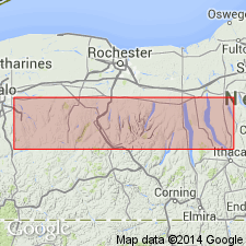
Basal fossiliferous layer of the Spafford Member of the Ludlowville Formation is here designated the Limerick Road Bed for exposures along Browns Creek upstream from the Limerick Road overpass in York, west-central NY. Unit is 18 to 157 cm thick and consists of calcareous to somewhat silty gray siliciclastic mudstone rich in molluscan debris, the tabulate coral PLEURODICTYUM, and the spiriferid brachiopods MEDIOSPIRIFER and ATHYRIS. It is easily distinguished from the medium gray to dark gray shales of the underlying Wanakah Member, which are characterized by a diminutive brachiopod fauna. The Limerick Road Bed extends from Bethany Center in Genesee Co. eastward into the Cayuga Valley and becomes unrecognizable southeast of Mack Creek. It underlies the "barren" mudstones of the Spafford Member. Age is Middle Devonian.
Source: GNU records (USGS DDS-6; Reston GNULEX).
For more information, please contact Nancy Stamm, Geologic Names Committee Secretary.
Asterisk (*) indicates published by U.S. Geological Survey authors.
"No current usage" (†) implies that a name has been abandoned or has fallen into disuse. Former usage and, if known, replacement name given in parentheses ( ).
Slash (/) indicates name conflicts with nomenclatural guidelines (CSN, 1933; ACSN, 1961, 1970; NACSN, 1983, 2005, 2021). May be explained within brackets ([ ]).