The National Geologic Map Database is migrating to a new infrastructure. We apologize for any service disruptions during this process.
|
|---|


- Usage in publication:
-
- Limekiln Spring Member*
- Modifications:
-
- Named
- AAPG geologic province:
-
- Great Basin province
Summary:
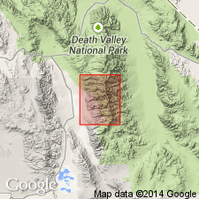
Unit is named the Limekiln Spring Member of the Kingston Range Formation of the Pahrump Group. Is exposed in the Telescope Peak 15' quad, Inyo Co., CA. Consists mainly of fine-grained metagraywacke, pelitic schist, and amphibolitic schist, and is divided into four map units: arkosic conglomerate containing clasts of older Proterozoic gneiss or of Beck Spring Dolomite interbedded with metamorphosed arkose and dolomite; thick dolomite beds; quartzite and calcareous quartzite; and argillite, schist, amphibolite, and metamorphosed conglomerate. The top of the member is marked by 60 to 100 m of thin-bedded calcareous quartzite and quartz arenite. Interfingers with the upper part of the Beck Spring Dolomite; locally unconformably overlies the Beck Spring Dolomite, Crystal Spring Formation, and older Proterozoic rocks; underlies the Surprise Member of the Kingston Peak Formation. Thickness ranges from 50 to 500 m. Age is Proterozoic. (B1565)
Source: GNU records (USGS DDS-6; Menlo GNULEX).
For more information, please contact Nancy Stamm, Geologic Names Committee Secretary.
Asterisk (*) indicates published by U.S. Geological Survey authors.
"No current usage" (†) implies that a name has been abandoned or has fallen into disuse. Former usage and, if known, replacement name given in parentheses ( ).
Slash (/) indicates name conflicts with nomenclatural guidelines (CSN, 1933; ACSN, 1961, 1970; NACSN, 1983, 2005, 2021). May be explained within brackets ([ ]).