- Usage in publication:
-
- Lime Ridge formation
- Modifications:
-
- Named
- Dominant lithology:
-
- Limestone
- Shale
- AAPG geologic province:
-
- Paradox basin
- San Juan basin
Summary:
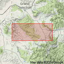
Named as the basal formation of the Hermosa Group. Type section is in the Al Hill et al. #1 State, sec 32, T40S, R20E, San Juan Co, UT in the Paradox basin. Lies in the subsurface in this well between 2052 and 2172 ft. Rocks of this interval were assigned to the Pinkerton Trail formation of the Hermosa group by earlier workers. Consists of clean, partly oolitic, dense, fossiliferous limestone and interbedded red to gray-green shale that has thin lentils of nodular limestone and nodules of chert. Fusulinids of Atokan, or Middle Pennsylvanian age collected. Ranges from 0 to 175 ft thick. Occurs in an area (isopach map) from Farmington, San Juan Co, NM and adjoining part of La Plata Co, CO in the San Juan basin, and Montezuma Co, CO west to San Juan, Garfield, Wayne, and Emery Cos, UT in the San Juan basin. Lower contact with Molas formation is gradational. Upper contact with Pinkerton Trail formation of Hermosa group is everywhere unconformable. Cross section. Is wholly a subsurface unit, mappable in a narrow band on the shelf rim of the salt basin. Is a marine unit.
Source: GNU records (USGS DDS-6; Denver GNULEX).
For more information, please contact Nancy Stamm, Geologic Names Committee Secretary.
Asterisk (*) indicates published by U.S. Geological Survey authors.
"No current usage" (†) implies that a name has been abandoned or has fallen into disuse. Former usage and, if known, replacement name given in parentheses ( ).
Slash (/) indicates name conflicts with nomenclatural guidelines (CSN, 1933; ACSN, 1961, 1970; NACSN, 1983, 2005, 2021). May be explained within brackets ([ ]).

