The National Geologic Map Database is migrating to a new infrastructure. We apologize for any service disruptions during this process.
|
|---|


- Usage in publication:
-
- Lima Conglomerate*
- Modifications:
-
- Revised
- AAPG geologic province:
-
- Montana folded belt
Summary:
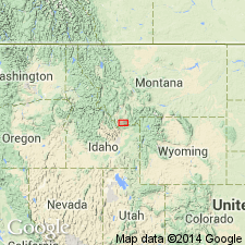
Lima conglomerate unit of Beaverhead Formation, Beaverhead Co, MT in the Montana folded belt province, an informal term of Ryder and Scholten (1973) raised to formation status as the basal formation of Beaverhead Group (raised in rank). Was derived from the Blacktail-Snowcrest uplift. Type section designated by Ryder and Scholten at sec 4, T15S, R8W, Beaverhead Co, MT. The conglomerate whose thickness is uncertain is exposed south and east of Lima in nearly continuous outcrops extending from Antone Peak west to east side of Lima Peaks. Is underlain unconformably by unnamed Campanian to Maestrichtian sandstone (parts of which were also formerly assigned to Beaverhead). Overlain conformably by a quartzite-roundstone conglomerate and sandstone of the Beaverhead (called Divide quartzite unit by Ryder and Scholten. Is of middle Campanian (palynomorphs--some palynomorphs were reworked) or Late Cretaceous age.
Source: GNU records (USGS DDS-6; Denver GNULEX).
- Usage in publication:
-
- Lima Conglomerate*
- Modifications:
-
- Revised
- AAPG geologic province:
-
- Montana folded belt
Summary:
Lower boundary of Beaverhead Group in Montana folded belt province revised downward from base of Lima Conglomerate to base of informally named Clover Creek sandstone unit. This change includes also incorporation of informally named Snowline sandstone unit above Clover Creek which intertongues with Lima. A quartzite conglomerate unit above Lima and in Beaverhead in Little Sheep Creek area about 2 mi south of Lima that was assigned to Divide conglomerate unit is removed from Divide and named Little Sheep Creek conglomerate unit. Assigned a Late Cretaceous, Campanian (78-84 Ma) age.
Source: GNU records (USGS DDS-6; Denver GNULEX).
For more information, please contact Nancy Stamm, Geologic Names Committee Secretary.
Asterisk (*) indicates published by U.S. Geological Survey authors.
"No current usage" (†) implies that a name has been abandoned or has fallen into disuse. Former usage and, if known, replacement name given in parentheses ( ).
Slash (/) indicates name conflicts with nomenclatural guidelines (CSN, 1933; ACSN, 1961, 1970; NACSN, 1983, 2005, 2021). May be explained within brackets ([ ]).