

- Usage in publication:
-
- Lick Creek sandstone member*
- Modifications:
-
- Original reference
- Dominant lithology:
-
- Sandstone
- Conglomerate
- AAPG geologic province:
-
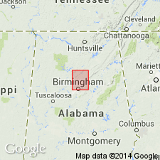
- Appalachian basin
Summary:
Pg. 9. Lick Creek sandstone member of Pottsville formation. Conglomerate and thin-bedded sandstone of wide extent, the conglomerate varying somewhat in character. Thickness about 50 feet. Is a member near middle of Pottsville formation in Warrior coal field. Is overlain by Jagger coal in some places, and in others the Jagger coal is included in the sandstone, near its top. The Lick Creek sandstone overlies Ream coal. Age is Pennsylvanian.
[Named from exposures along Lick Creek in vicinity of Kimberly, Jefferson Co., central AL.]
Source: US geologic names lexicon (USGS Bull. 896, p. 1179).

- Usage in publication:
-
- Lick Creek Sandstone Member*
- Modifications:
-
- Overview
- AAPG geologic province:
-
- Appalachian basin
Summary:
Pg. 55, 56. Lick Creek Sandstone Member of Pottsville Formation. A fine- to coarse-grained well-indurated sandstone, conglomeratic in part, that averages about 50 feet in thickness. The sandstone contains rounded pebbles, as much as an inch in diameter, of quartz or quartzite; black gray, green, brown, and red chert pebbles; and occasional metamorphic rock fragments. Lies beneath the Mary Lee coal group. Present in Warrior coal field, Appalachian Plateaus province. [Age is Early Pennsylvanian (Morrowan).]
See also Charles Butts, 1910, USGS Geol. Atlas of the US, Birmingham folio, no. 175, p. 9; W.C. Culbertson, 1964, USGS Bull. 1182-B, p. B18.
Source: Publication.
For more information, please contact Nancy Stamm, Geologic Names Committee Secretary.
Asterisk (*) indicates published by U.S. Geological Survey authors.
"No current usage" (†) implies that a name has been abandoned or has fallen into disuse. Former usage and, if known, replacement name given in parentheses ( ).
Slash (/) indicates name conflicts with nomenclatural guidelines (CSN, 1933; ACSN, 1961, 1970; NACSN, 1983, 2005, 2021). May be explained within brackets ([ ]).