- Usage in publication:
-
- Leray Limestone†
- Modifications:
-
- Abandoned
- AAPG geologic province:
-
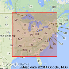
- Appalachian basin
Summary:
Revised abstract and errata sheet abandon name Leray Limestone as it has proved to be simply the basal few feet of the Trentonian Watertown. Leray originally included by author as upper formation in the Black River Group. Strata described as Leray in report, actually constitutes upper Lowville.
Source: GNU records (USGS DDS-6; Reston GNULEX).
For more information, please contact Nancy Stamm, Geologic Names Committee Secretary.
Asterisk (*) indicates published by U.S. Geological Survey authors.
"No current usage" (†) implies that a name has been abandoned or has fallen into disuse. Former usage and, if known, replacement name given in parentheses ( ).
Slash (/) indicates name conflicts with nomenclatural guidelines (CSN, 1933; ACSN, 1961, 1970; NACSN, 1983, 2005, 2021). May be explained within brackets ([ ]).

