The National Geologic Map Database is migrating to a new infrastructure. We apologize for any service disruptions during this process.
|
|---|


- Usage in publication:
-
- Lequire sandstone member*
- Modifications:
-
- Original reference
- Dominant lithology:
-
- Sandstone
- AAPG geologic province:
-
- Chautauqua platform
- Arkoma basin
Summary:
Pg. 503-520. Lequire sandstone member of McAlester shale. Massive sandstone; medium texture; friable; brown to gray; plant remains. Thickness in Muskogee-Porum area 12 to 25 feet. Lies 8 to 40 feet above Warner sandstone member and 40 feet below Cameron sandstone member. Age is Pennsylvanian. Report includes geologic map, columnar sections, measured sections.
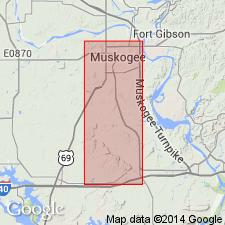
Named from exposure a little north of Lequire, in secs. 4 and 5, T. 7 N., R. 22 E., and secs. 32, 33, and 34, T. 8 N., R. 22 E., Haskell Co., eastern OK. Recognized in Muskogee, Haskell, McIntosh, and adjacent counties.
Source: US geologic names lexicon (USGS Bull. 896, p. 1172); supplemental information from GNU records (USGS DDS-6; Denver GNULEX).
- Usage in publication:
-
- Lequire sandstone member*
- Modifications:
-
- Principal reference
- AAPG geologic province:
-
- Arkoma basin
Summary:
Pg. 37-38, pl. 1. Lequire sandstone member of McAlester formation. Further described in Haskell County, eastern Oklahoma, where it is made up largely of thin slabby beds of fine-grained sandstone, commonly showing ripple marks. At type locality, total computed thickness about 150 feet. In some areas, rests on Warner sandstone member but, in other areas, is separated from it by an unnamed member of variable thickness; separated from overlying Keota sandstone member by an unnamed shale member. Type locality mentioned by Wilson (1935) is inapplicable because it is in reality occupied by outcrops of the Warner; new type locality designated. Age is Middle Pennsylvanian (Des Moines). Report includes geologic map, measured sections, nomenclature history.
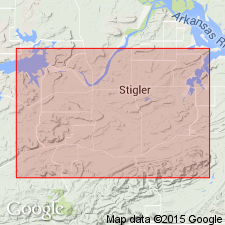
Type locality: in sec. 31, T. 8 N., E. 21 E., 1.5 mi northwest of Lequire, Haskell Co., eastern OK.
Source: Publication; US geologic names lexicon (USGS Bull. 1200, p. 2155).
For more information, please contact Nancy Stamm, Geologic Names Committee Secretary.
Asterisk (*) indicates published by U.S. Geological Survey authors.
"No current usage" (†) implies that a name has been abandoned or has fallen into disuse. Former usage and, if known, replacement name given in parentheses ( ).
Slash (/) indicates name conflicts with nomenclatural guidelines (CSN, 1933; ACSN, 1961, 1970; NACSN, 1983, 2005, 2021). May be explained within brackets ([ ]).