The National Geologic Map Database is migrating to a new infrastructure. We apologize for any service disruptions during this process.
|
|---|


- Usage in publication:
-
- Leonard formation
- Modifications:
-
- First used
- Dominant lithology:
-
- Sandstone
- Limestone
- Chert
- Shale
- AAPG geologic province:
-
- Permian basin
Summary:
Pg. 51. Leonard formation. In Leonard Mountain and to north consists of (descending): (1) thinly laminated yellowish sandstone interbedded with layers of gray limestones, yellow chert, and gray shales; (2) heavy and thin bedded gray limestone, in part conglomeratic or containing pebbles of different sizes; (3) shales and soft sandstones interbedded with a dark gray limestone; (4) at base conglomerate 20 to 200 feet thick. Thickness of formation 1,800 to 2,300 feet. Underlies Word formation and unconformably overlies Haymond formation (Pennsylvanian). [Included Hess formation of later reports.]
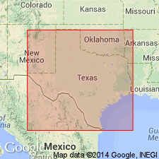
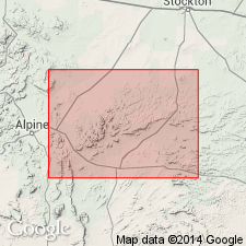
Forms greater part of south face of Leonard Mountain, Hess Canyon quadrangle, Marathon region, Brewster Co., western TX.
Overlies Hess formation and underlies Word formation (both first used in this report). "The upper part is composed of thinly laminated yellowish sandstone interbedded with layers of gray limestone, yellow chert and gray shales. The lower part consists of heavy and thinly bedded gray limestone, in part conglomeratic or containing pebbles of different size. At the base, shales and soft sandstones are interbedded with a dark-gray limestone. The thickness of the entire series is nearly 1,800 ft. Farther to the east near Word's Ranch, the series is much more calcareous, in the upper and middle part; the thickness is more than 2,300 ft. Toward the west of the first mentioned section, the shales begin to predominate while the limestone is reduced in thickness. At the base of this formation is a conglomerate from 20 to 220 ft thick, and this unconformably overlies the Pennsylvanian." Is of Permian age. Geologic map [on which the Permian is shown undivided].
Source: GNU records (USGS DDS-6; Denver GNULEX).
- Usage in publication:
-
- Leonard formation
- Modifications:
-
- Overview
- AAPG geologic province:
-
- Permian basin
Summary:
Makes up the greater part of south face of Leonard Mountain in Glass Mountains, Brewster Co, TX, Permian basin, where 4 sections measured. Characterized by the presence of sand, pebbles, and boulders in nearly all of its limestones. From top to base contains layers of coarse clastic material (such as conglomerates consisting of boulders and pebbles of limestone and chert) derived from the older formations exposed in the region, with a preponderance of limestones from formations immediately underlying. In lower two-thirds, limestones and conglomerates are predominant. In remaining one-third is mostly shale, intercalated by well-cemented calcareous shell breccias. Fossils abundant throughout. In lower limestones, crinoidal material abundant and joints of large crinoid stems common. Middle part of unit contains many cup corals, and the intercalated thin limestones in the shales of upper part are characterized by presence of large Productus and a Waagenoceras. Many of the limestones are oolitic. Overlies Hess formation (which is distinguished by its well-defined bedding planes); conformably underlies Word formation (which is distinguished by coarser sediments, bituminous material). Believed to correlate with Clear Fork in western TX; perhaps also includes basal part of Double Mountain, upper part of Albany limestones. Contains many forms of the Delaware of Girty. Thickness varies in the 4 sections. Permo-carboniferous. Fossil list. Geologic map.
Source: GNU records (USGS DDS-6; Denver GNULEX).
- Usage in publication:
-
- Leonard formation
- Modifications:
-
- Revised
- Overview
- AAPG geologic province:
-
- Permian basin
Summary:
Leonard formation revised in Udden's (1917) "type section" [not actually so designated by Udden] in Leonard Mountain, Glass Mountains, Brewster Co, TX in Permian basin--lower half of Udden's "type section" here found to be Hess formation, a fact suspected by Udden. Hess is also present in lower part of Udden's Leonard sections farther west. Great lateral variation in thickness; thins from west to east across Glass Mountains, and may be divided into a western and an eastern facies. Thickest sections are to the southwest--3 mi southwest of Lenox, and south of Sullivan Peak, 4 mi northwest of Lenox; 1,800 ft thick in both sections. Thins to northeast, and is 900 ft thick in Leonard Mountain. Western facies consists mostly of hard, brown, platy siliceous shale, with which thin layers of limestone are interbedded. Beginning 2 mi southwest of Word ranch, eastern facies extends northeastward and does not exceed 300 ft. Lower part of this facies consists of limestone full of well-rounded chert and quartz pebbles, passing upward into fossiliferous limestones interbedded with marls and siliceous shales. To east shales and marls lens out, and limestones change to dolomite. Lateral thickness change interpreted to mean that southwest part of report area was rising during Hess time, and that different amounts of synchronous deposition occurred in different places. Abundant and varied fauna. Geologic map, sections. Permian age.
Source: GNU records (USGS DDS-6; Denver GNULEX).
- Usage in publication:
-
- Leonard formation
- Modifications:
-
- Revised
- AAPG geologic province:
-
- Permian basin
Summary:
Leonard formation revised in Sierra Diablo area, Culberson County, Texas, to include Leonard age strata previously assigned to lower part of Delaware Mountain formation by Darton (1928). Darton divided Delaware Mountain formation into (ascending) "basal black limestone", "Delaware Mountain sandstone", and "upper dark limestone" members. The Delaware Mountain formation as originally defined is not a natural group, but consists of beds of Leonard age ("basal black limestone") and Word age ("Delaware Mountain sandstone" and "upper dark limestone"), separated by an unconformity. In this report, authors propose name Bone Canyon member of Leonard formation for Darton's "basal black limestone." Bone Canyon contains fossils of Leonard age; is 500 to 1,000 feet thick; conformably overlies 500 feet of massive limestone containing rich Hess fauna. Beneath the unconformity at base of "Delaware Mountain sandstone member", separating Bone Canyon member from that sandstone, is newly named Victorio Peak member, a wedge of gray limestone, 500 to 1,000 feet thick, containing the brachiopod PRODUCTUS IVESI and other forms which serve to correlate it with the Leonard on one hand, and the San Andres[?] on the other. Where Victorio Peak member is absent (in Guadalupe Mountains), the "Delaware Mountain sandstone member" of Delaware Mountain formation unconformably overlies Bone Canyon member of Leonard. Report includes measured sections. [See also entries under Bone Canyon (Bone Spring), Victorio Peak, and Delaware Mountain.]
Source: US geologic names lexicon (USGS Bull. 896, p. 233-234, 592, 2247-2248); supplemental information from GNU records (USGS DDS-6; Denver GNULEX).
- Usage in publication:
-
- Leonard formation*
- Modifications:
-
- Revised
- AAPG geologic province:
-
- Permian basin
Summary:
Leonard formation revised--name here applied to all beds between the Wolfcamp formation (below) and the Word formation (above), with Hess formation reduced in rank and assigned as a limestone member of Leonard. Report area is Glass Mountains, Brewster Co, TX in Permian basin. Aggregate thickness of Leonard about 2,000 ft. To southwest the formation consists of interbedded siliceous shale (with Radiolaria), clay shale, and sandstone. Here occur many thin beds of limestone, which contain fossil fragments and pebbles of limestone and chert, probably derived from the erosion of the Marathon folds to the south. Basal part of formation consists of massive limestone, which thickens northeastward. Above there are 5 other members of massive limestone. In northeastern part of the mountains, the shaly beds occupy only a small thickness in upper part of formation. Beneath is a mass of thin-bedded, dirty gray dolomitic limestone with few fossils other than fusulinids. This is the Hess thin-bedded limestone member of the Leonard. Permian age. Correlation chart. Measured sections.
Source: GNU records (USGS DDS-6; Denver GNULEX).
- Usage in publication:
-
- Leonard formation*
- Modifications:
-
- Revised
- Overview
- AAPG geologic province:
-
- Permian basin
Summary:
Leonard formation revised in report area, Marathon region of TX in Permian basin--limestones typical of the Hess formation were found by the author in 1932 to be largely equivalent to the shales and thin limestones typical of the Leonard formation; the two facies were interpreted as being separated by limestone reefs. In this report these two facies are brought together in a single formation--the Leonard--in accordance with Udden's original definition, and the Hess is designated the "Hess thin-bedded limestone member". Leonard and Hess crop out in the Glass Mountains, Brewster Co, TX. Leonard unconformably overlies Wolfcamp formation; conformably underlies Word formation. Fossils discussed in detail. Stratigraphic diagrams, structural maps. Geologic map, on which Leonard formation is shown undivided. Is of Permian age.
Source: GNU records (USGS DDS-6; Denver GNULEX).
- Usage in publication:
-
- Leonard formation
- Modifications:
-
- Not used
Summary:
The authors advocate classification of American Permian as a system composed of 4 sedimentary divisions of series rank, based on section exposed adjacent to Delaware basin of west TX and southeastern NM in Permian basin. Divisions are (ascending): Wolfcamp, Leonard, Guadalupe, and Ochoa series [all first used as series terms]. Leonard series comprises beds formerly assigned to Leonard formation; term formation not used--raised to series rank. At type locality, south face of Glass Mountains (Brewster CO, TX), Leonard is more than 1,800 ft thick and consists of limestones and dark siliceous shales. Rests disconformably on Wolfcamp and underlies Word formation of lower Guadalupe age with seeming conformity. Characterized by brachiopods PRORICHTHOFENIA, SCACCHINELLA, and the diagnostic DICTYOCLOSTUS BASSI McKee; ammonoid PERRINITES; and the common fusulinids are primitive types of PARAFUSULINA. Leonard equivalents include Bone Spring formation of Sierra Diablo and Delaware and Guadalupe Mountains, Yeso and possibly San Andres formations of NM, and, in terms of older nomenclature, part of Wichita-Albany group plus all of Clear Fork group plus part of Double Mountain group in central TX. In OK and KS extends from horizon near top of Herington limestone to top of Dog Creek shale (i.e., base of Whitehorse group). In KS and NE units of Big Blue and Cimarron series should be reclassified. In OK term Minco should be dropped in favor of Leonard series.
Source: GNU records (USGS DDS-6; Denver GNULEX).
- Usage in publication:
-
- Leonard formation
- Modifications:
-
- Contact revised
- AAPG geologic province:
-
- Permian basin
Summary:
Leonard formation revised--lower contact changed in Glass Mountains, Brewster Co, TX in Permian basin. Nealranch formation (base) and Lenoxhills formation (top) first used in this report as replacements for Wolfcamp formation of Udden (1917) in Wolfcamp type locality (Wolf Camp Hills, Glass Mountains). "Nealranch formation embraces the upper part of beds originally called Wolfcamp by Udden (1917) in the Wolf Camp Hills and is renamed to retain this widely used name for the time-stratigraphic unit, the Wolfcamp Series." The Leonard formation unconformably overlies the Lenoxhills formation in western Glass Mountains. Locally pre-Leonard erosion has removed most of the Lenoxhills; in some areas the base of the Leonard rests on the truncated edges of the folded and faulted beds of Marathon orogenic belt. In eastern Glass Mountains Leonard overlies the limestone and shale of Lenoxhills with no apparent unconformity; merely a sharp facies change. Lenoxhills formation unconformably overlies the Nealranch, Gaptank, and older strata of the Marathon orogenic belt. Composite stratigraphic section. Fossils drawn and discussed in detail.
Source: GNU records (USGS DDS-6; Denver GNULEX).
For more information, please contact Nancy Stamm, Geologic Names Committee Secretary.
Asterisk (*) indicates published by U.S. Geological Survey authors.
"No current usage" (†) implies that a name has been abandoned or has fallen into disuse. Former usage and, if known, replacement name given in parentheses ( ).
Slash (/) indicates name conflicts with nomenclatural guidelines (CSN, 1933; ACSN, 1961, 1970; NACSN, 1983, 2005, 2021). May be explained within brackets ([ ]).