

- Usage in publication:
-
- Lennep sandstone*
- Modifications:
-
- Named
- Dominant lithology:
-
- Sandstone
- Shale
- AAPG geologic province:
-
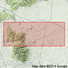
- Montana folded belt
Summary:
Pg. 746. Lennep sandstone. Dark-colored tuffaceous sandstone with intercalated shale; contains bands of brown cannonball nodules 8 to 12 inches in diameter at several localities in Crazy Mountains region, Montana. Thickness 250 to 400 feet. Underlies Lance formation (new) and overlies Bearpaw shale. Distinguished from the overlying light-gray sandstones of the Lance and the underlying black shales of the Bearpaw by its dark-brown color. Not definitely correlated with Fox Hills sandstone. Considered equivalent to part of Livingston formation to the west. Contains fresh-water, brackish-water, and marine plant fossils; notably marine HALYMENITES MAJOR Lesquereux. Age is Late Cretaceous. Report includes cross section, fossil list. [See also M.G. Wilmarth, 1938, Geologic Names Committee remark (USGS Bull. 896, p. 762) under Fort Union.]
Named from exposures at Lennep Station, on the Chicago, Milwaukee, Saint Paul, and Pacific RR, at northern end of Crazy Mountains, Meagher Co., MT. [According to GNU records (USGS DDS-6; Denver GNULEX, Jan. 22, 1990), type locality not designated.]
[Discrepancy: US geologic names lexicon (USGS Bull. 896, p. 1169) states the Lennep ranges from 250 to 400 feet thick, and is Not definitely correlated with Fox Hills sandstone. GNU records (USGS DDS-6; Denver GNULEX, Jan. 22, 1990) state that the Lennep ranges from 250 to 460 feet thick, and Is correlated with the Fox Hills. --unresolved.]
Source: US geologic names lexicon (USGS Bull. 896, p. 762, 1169); supplemental information from GNU records (USGS DDS-6; Denver GNULEX).
- Usage in publication:
-
- Lennep Sandstone*
- Modifications:
-
- Overview
- AAPG geologic province:
-
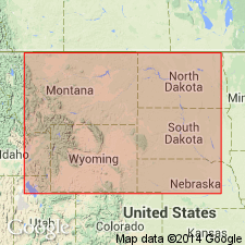
- Montana folded belt
Summary:
Assigned to Montana Group in Bruno siding area, Meagher Co, MT, Montana folded belt province. Here Montana consists of (ascending) Telegraph Creek Formation, Virgelle Sandstone Member of Eagle Sandstone, [main body of] Eagle, Claggett Shale, Parkman Sandstone, Judith River Formation, Bearpaw Shale, Lennep Sandstone, and Hell Creek Formation. Lennep is a shallow-water volcanic-rich marine sandstone and contains local beach placers rich in heavy minerals. Late Cretaceous age.
Source: GNU records (USGS DDS-6; Denver GNULEX).
- Usage in publication:
-
- Lennep Sandstone Member*
- Modifications:
-
- Revised
- Reference
- Dominant lithology:
-
- Sandstone
- Tuff
- AAPG geologic province:
-
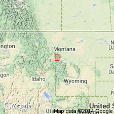
- Montana folded belt
Summary:
Reduced in stratigraphic rank in report area in the Montana folded belt province to a member of Sedan Formation (new) of Livingston Group (new affiliation). Reference section designated in S1/2 SW1/4 sec 17, T4N, R8E, where a 107 m (350.9 ft) section was measured. Composed of gray volcanic sandstone that may be very fine, fine- to medium-grained to conglomeratic, poorly bedded, thin-bedded to slabby at reference section. Some beds are noncalcareous and show rude cross bedding. Some dark-brown-weathering calcareous nodules, fossil conifer wood, and some carbonaceous material. Crystal lithic tuff and a basal siliceous gray to brown mudstone present in reference section. Overlies Bearpaw Shale Member (new rank) of Sedan in northern Wallrock and southern Sixteen NE quads; elsewhere overlies mudstone member of Sedan. Underlies Billman Creek Formation. Dinosaur bone fragments, fresh- and brackish-water mollusks, and burrows of a marine crustacean found indicate a marine deposit of late Campanian, Late Cretaceous age.
Source: GNU records (USGS DDS-6; Denver GNULEX).
For more information, please contact Nancy Stamm, Geologic Names Committee Secretary.
Asterisk (*) indicates published by U.S. Geological Survey authors.
"No current usage" (†) implies that a name has been abandoned or has fallen into disuse. Former usage and, if known, replacement name given in parentheses ( ).
Slash (/) indicates name conflicts with nomenclatural guidelines (CSN, 1933; ACSN, 1961, 1970; NACSN, 1983, 2005, 2021). May be explained within brackets ([ ]).