

- Usage in publication:
-
- Lenapah limestone
- Modifications:
-
- Named
- Dominant lithology:
-
- Limestone
- AAPG geologic province:
-
- Chautauqua platform
Summary:
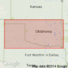
Named as basal formation (of 3) in the northern area of the Sapulpa group; named for the town of Lenapah, Nowata Co, OK, Chautauqua platform. No type locality designated. Occurs near the KS State line entirely east of the Verdigris River. Is the cap rock of most of the hills in northeast part of the Nowata quadrangle. Consists of a single bed of fossiliferous limestone which, when unaltered, is a dense, blue, and partly crystalline usually containing much fossils, especially brachiopods. Has little or no chert. Thickness of the formation is approximately 20 ft in the quarry 3 mi north of Lenapah; at Nowata, is 6-8 ft thick; less than 30 inches thick south of Nowata. Overlies Nowata shales (new) of Tulsa group; underlies Curl formation (new) of Sapulpa group. Stratigraphic chart. Of Pennsylvanian age.
Source: GNU records (USGS DDS-6; Denver GNULEX).
- Usage in publication:
-
- Lenapah limestone
- Modifications:
-
- Revised
- AAPG geologic province:
-
- Chautauqua platform
- Cherokee basin
Summary:
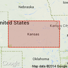
Is a formation (1 of 8) of the Marmaton group in southeastern KS. Divided into the following newly named members (ascending order): Norfleet limestone, Perry Farm shale, and Idenbro limestone members. Identified in KS along its outcrop from southern boundary at Coffeyville to central Linn Co; also seen in eastern part of Cass Co, MO. Extends into Labette Co, KS in the Cherokee basin. Type exposure designated in the old quarry in the NW1/4 NE1/4 sec 30, T28N, R16E, Nowata Co, OK, at Bell Spur, a short distance north of Lenapah on the Chautauqua platform. At the base of the Lenapah is a thin, dark, slabby limestone overlain by 5+ ft of shale which in most places is dark gray. Above this shale is a limestone which is locally as much as 3 ft thick. Above this is a fossiliferous shale with nodular limestone beds ranging in thickness from 5 to 10 ft. Above this and at top of Lenapah is a light-gray, somewhat nodular, but more wavy-bedded and "pseudo-brecciated" limestone with horn corals and ACULOPORA; ranges from 2 to 10 ft in Labette Co. Overlies Nowata shale and underlies Memorial shale, both of the Marmaton group. Measured sections. Cross section. Of Pennsylvanian, Des Moines age.
Source: GNU records (USGS DDS-6; Denver GNULEX).
For more information, please contact Nancy Stamm, Geologic Names Committee Secretary.
Asterisk (*) indicates published by U.S. Geological Survey authors.
"No current usage" (†) implies that a name has been abandoned or has fallen into disuse. Former usage and, if known, replacement name given in parentheses ( ).
Slash (/) indicates name conflicts with nomenclatural guidelines (CSN, 1933; ACSN, 1961, 1970; NACSN, 1983, 2005, 2021). May be explained within brackets ([ ]).