The National Geologic Map Database is migrating to a new infrastructure. We apologize for any service disruptions during this process.
|
|---|


- Usage in publication:
-
- Lemons Bluff member
- Modifications:
-
- Incidental mention
Summary:
Pg. 3, 5, 8. Lemons Bluff member of Marble Falls formation. Incidental mention in connection with study of limestones suitable for manufacture of rock wool.
Source: US geologic names lexicon (USGS Bull. 1200, p. 2145).
- Usage in publication:
-
- Lemons Bluff member
- Modifications:
-
- Original reference
- Dominant lithology:
-
- Limestone
- Shale
- AAPG geologic province:
-
- Llano uplift
Summary:
Pg. 67-69. Lemons Bluff member of Marble Falls formation. Black subcrystalline uniformly bedded siliceous chert-bearing limestone weathering to yellowish and grayish-brown tints; locally contains quantities of minute sponge spicules. Layers are 2 to 12 inches thick and characterized by flat smooth surfaces and commonly separated by thin partings of shaly limestone. Member changes to shale beds eastward and crops out at McAnelly's Bend along Colorado River west of Bend as black fissile shale containing thin layers of dense black limestone. This shale has long been considered typical Smithwick; it ranges in thickness from a few feet to 125 feet and unconformably overlies Big Saline beds. Underlies Smithwick formation. Age is Early Pennsylvanian.
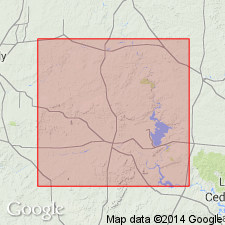
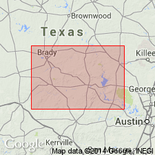
Lemons Bluff is on San Saba River, San Saba Co., central TX.
Source: US geologic names lexicon (USGS Bull. 1200, p. 2145).
- Usage in publication:
-
- Lemons Bluff member
- Modifications:
-
- Revised
- AAPG geologic province:
-
- Llano uplift
Summary:
Pg. 196 (table 2), 197-198; 1947, Jour. Paleo., v. 21, no. 2, p. 142, 143, 144. Lemons Bluff member of Big Saline formation. Reallocated to member status in Big Saline formation, central Texas. Thickness 20 to 60 feet. East of Cavern Ridge (Llano region) underlies Brister member (new) and overlies Aylor member (new); west of Cavern Ridge underlies Soldiers Hole member (new) and overlies Brook Ranch member (new); absent southwest of Brook Ranch in McCulloch County. Age is Early Pennsylvanian.
Source: US geologic names lexicon (USGS Bull. 1200, p. 2145).
For more information, please contact Nancy Stamm, Geologic Names Committee Secretary.
Asterisk (*) indicates published by U.S. Geological Survey authors.
"No current usage" (†) implies that a name has been abandoned or has fallen into disuse. Former usage and, if known, replacement name given in parentheses ( ).
Slash (/) indicates name conflicts with nomenclatural guidelines (CSN, 1933; ACSN, 1961, 1970; NACSN, 1983, 2005, 2021). May be explained within brackets ([ ]).