

- Usage in publication:
-
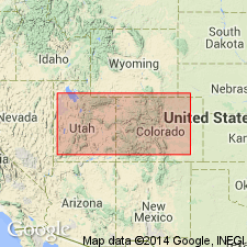
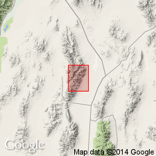
- Lehman formation
- Modifications:
-
- Named
- Dominant lithology:
-
- Shale
- Quartzite
- Limestone
- AAPG geologic province:
-
- Great Basin province
Summary:
Named as the uppermost of six formations of Pogonip group for exposures near Lehman Caves in the Snake River Range, White Pine Co., NV in the Great Basin province. Type locality designated as the Ibex section in SE1/4 sec 24, T22S, R15W, Millard Co., UT. Is a thin- to thick-bedded, fossiliferous, blue-gray calcilutite that alternates with reddish-brown to gray, cross-laminated and laminated quartzite, and shale. Is 196 ft thick at its type section where it overlies Kanosh shale (new, of Pogonip) and underlies Swan Peak (?) quartzite. Is fossiliferous (ostracods). Assigned to the Ordovician.
Source: GNU records (USGS DDS-6; Denver GNULEX).
- Usage in publication:
-
- Lehman Limestone*
- Modifications:
-
- Redescribed
- Dominant lithology:
-
- Limestone
- AAPG geologic province:
-
- Great Basin province
Summary:
Redescribed from Lehman Formation to Lehman Limestone, upper formation of the Pogonip Group in report area. Consists of ledgy slopes and minor cliffs of flaggy and slabby, laminated to thin-bedded, tabular to nodular, light- to medium-gray limestone and grayish-yellow to -orange, silty and fine quartz sandy limestone and common bioclastic and intraformational rip-up limestone conglomerate-breccia beds 4 to 8 inches thick. Upper 50-60 ft consists of sandy limestone, limy sandstone, and well-rounded fine to medium quartz sandstone. Some beds bioturbated, especially in upper 6 ft. Is 400 to 500 ft thick. Fossiliferous (trilobites, brachiopods, snails, sponge spicules, algae, ostracods). Overlies Kanosh Shale of Pogonip. Underlies Eureka Quartzite. Middle Ordovician age.
Source: GNU records (USGS DDS-6; Denver GNULEX).
For more information, please contact Nancy Stamm, Geologic Names Committee Secretary.
Asterisk (*) indicates published by U.S. Geological Survey authors.
"No current usage" (†) implies that a name has been abandoned or has fallen into disuse. Former usage and, if known, replacement name given in parentheses ( ).
Slash (/) indicates name conflicts with nomenclatural guidelines (CSN, 1933; ACSN, 1961, 1970; NACSN, 1983, 2005, 2021). May be explained within brackets ([ ]).