

- Usage in publication:
-
- Leeds Creek Member*
- Modifications:
-
- Named
- Dominant lithology:
-
- Limestone
- AAPG geologic province:
-
- Green River basin
- Snake River basin
- Yellowstone province
- Uinta basin
- Wasatch uplift
- Uinta uplift
Summary:
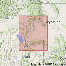
Named as one of seven members of Twin Creek Limestone for Leeds Creek. Type section measured on north side, Leeds Creek Canyon, SW1/4 sec 30, T23N, R118 W and SE1/4 sec 25, T23N, R119W, Lincoln Co, WY, Greater Green River basin. Called member F of Twin Creek in earlier reports. Is 1,118 ft thick at type. Is the thickest, most conspicuous of the members. Ranges from 260 to 1,600 ft thick. Thickens westward from 330 ft thick in Jackson Hole, WY in Yellowstone province to 1,145 ft at Willow Creek, Bonneville Co, ID, Snake River basin, and from 115 ft at Lake Fork, Duchesne Co, UT, Uinta basin to 1,500 ft at Burr Oak, Utah Co, UT on Wasatch uplift. Occurs in Summit Co, UT on Uinta uplift. Consists mainly of soft dense light gray shaly limestone. Some beds are thick; some are oolitic, silty, sandy and ripple marked. Five other measured sections. Overlies Watton Canyon Member (new) of Twin Creek gradationally. Underlies Giraffe Creek Member (new) of Twin Creek. Weathers into pencil-like splinters. Fossils (crinoids, echinoids, pelecypods). Assigned an early Callovian, Late Jurassic age. Correlates with Rierdon Formation, Stockade Beaver Member of Sundance Formation, upper Twelvemile Canyon Member of Arapien Shale, and upper Carmel Formation. Deposited on eastern margin in shallow water. Correlation chart. Cross sections.
Source: GNU records (USGS DDS-6; Denver GNULEX).

- Usage in publication:
-
- Leeds Creek Member*
- Modifications:
-
- Overview
- Age modified
- AAPG geologic province:
-
- Snake River basin
- Yellowstone province
- Wasatch uplift
- Uinta basin
- Uinta uplift
Summary:
Is one of seven members of Twin Creek Limestone. Conformably overlies Watton Canyon Member of Twin Creek and conformably underlies Giraffe Creek Member of Twin Creek in the Snake River basin, ID, Yellowstone province, WY, Wasatch uplift, Uinta basin, and Uinta uplift, UT. Correlation charts show thickness and lithology as well as correlation of Leeds Creek with part of Sundance, Carmel, and Arapien Formations. Extends east in UT as far as the Duchesne River, Duchesne Co, Uinta basin. Age changed from early Callovian, Late Jurassic to late Bathonian, Middle Jurassic.
Source: GNU records (USGS DDS-6; Denver GNULEX).
For more information, please contact Nancy Stamm, Geologic Names Committee Secretary.
Asterisk (*) indicates published by U.S. Geological Survey authors.
"No current usage" (†) implies that a name has been abandoned or has fallen into disuse. Former usage and, if known, replacement name given in parentheses ( ).
Slash (/) indicates name conflicts with nomenclatural guidelines (CSN, 1933; ACSN, 1961, 1970; NACSN, 1983, 2005, 2021). May be explained within brackets ([ ]).