- Usage in publication:
-
- Leavick Tarn Dolomite Member
- Modifications:
-
- Named
- Dominant lithology:
-
- Limestone
- Dolomite
- AAPG geologic province:
-
- South Park basin
- Denver basin
- Piceance basin
Summary:
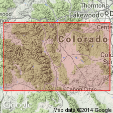
Named as the upper member of Manitou Formation (rank term changed from Limestone in its southeastern facies), upper formation of Horseshoe Mountain Group. Name replaces term Fairplay Member (provisionally named) of Manitou Limestone. Southeastern facies is recognized near Salida, Gunnison Co, Piceance basin; Colorado Springs, El Paso Co, Denver basin; and at Fairplay, Park Co, South Park basin. Type section measured on north wall of cirque on east side of Horseshoe Mountain about 1/4 mi east of west Park Co line along west extension of line between secs. 7 and 18, T. 10 S., R. 78 W., Park Co, CO in the South Park basin. At type Leavick Tarn conformably overlies Ptarmigan Chert Member (new) of Manitou and unconformably underlies the Devonian Parting Sandstone. Is 35.4 ft thick at type; is 31.9 ft thick at type section of Manitou. Consists of gray, gray-tan to black dolomite and gray dolomitic wavy bedded limestone at top. The dolomite ranges from massive to mottled. Some dolomite belts are coarse grained and some are vugular. Correlation chart, measured sections. Correlated with upper part of Tie Gulch Dolomite of northwestern facies of the Manitou. Of Early Ordovician age.
Source: GNU records (USGS DDS-6; Denver GNULEX).
For more information, please contact Nancy Stamm, Geologic Names Committee Secretary.
Asterisk (*) indicates published by U.S. Geological Survey authors.
"No current usage" (†) implies that a name has been abandoned or has fallen into disuse. Former usage and, if known, replacement name given in parentheses ( ).
Slash (/) indicates name conflicts with nomenclatural guidelines (CSN, 1933; ACSN, 1961, 1970; NACSN, 1983, 2005, 2021). May be explained within brackets ([ ]).

